 English
  Español
 EISP History: 2000s
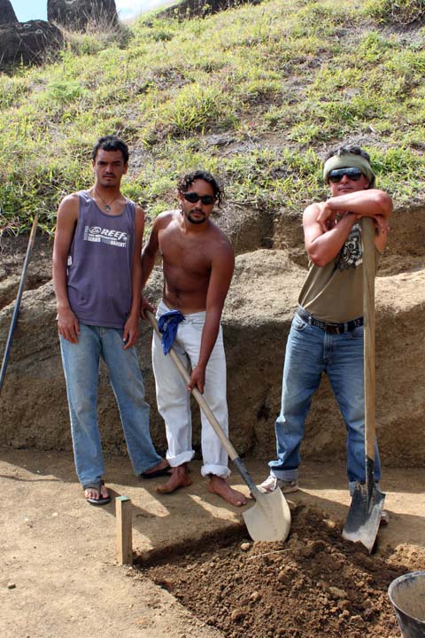
Phase 2 Season 2
Easter Island Statue Project
March 16 – April 14, 2014
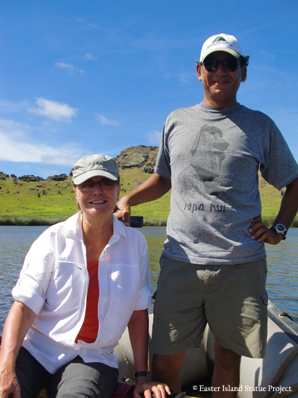
Dr. Jo Anne Van Tilburg, UCLA Project Director
Cristián Arévalo Pakarati/ Rapa Nui Project Co-director
José Miguel Ramírez A., Universidad de Valparaiso, Co-investigator
Introduction
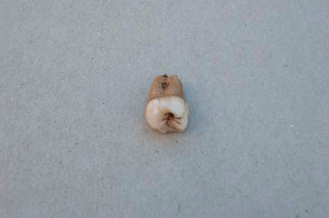
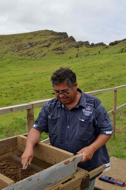
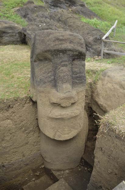
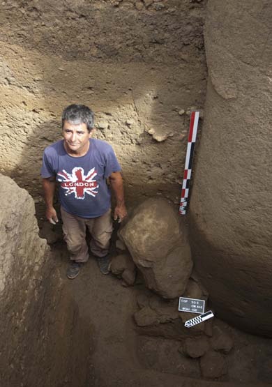
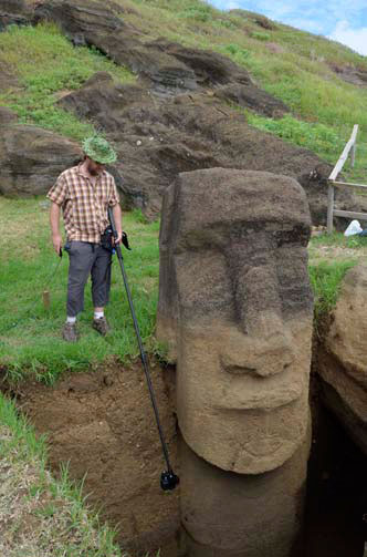
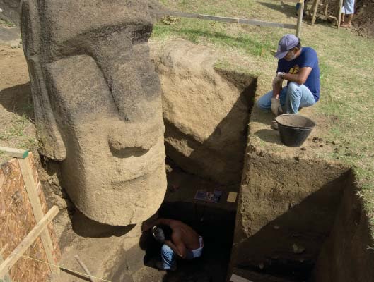
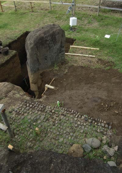
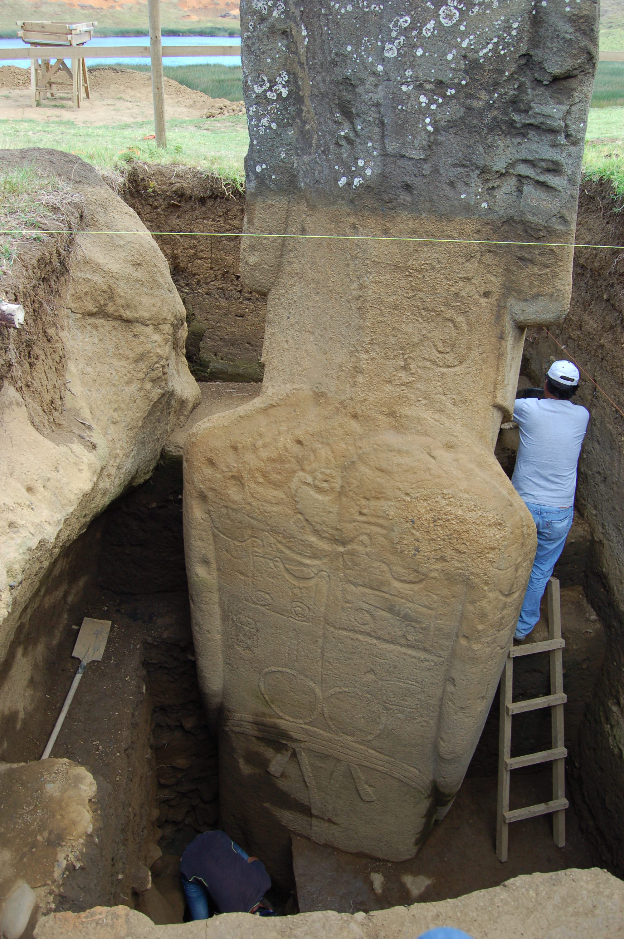
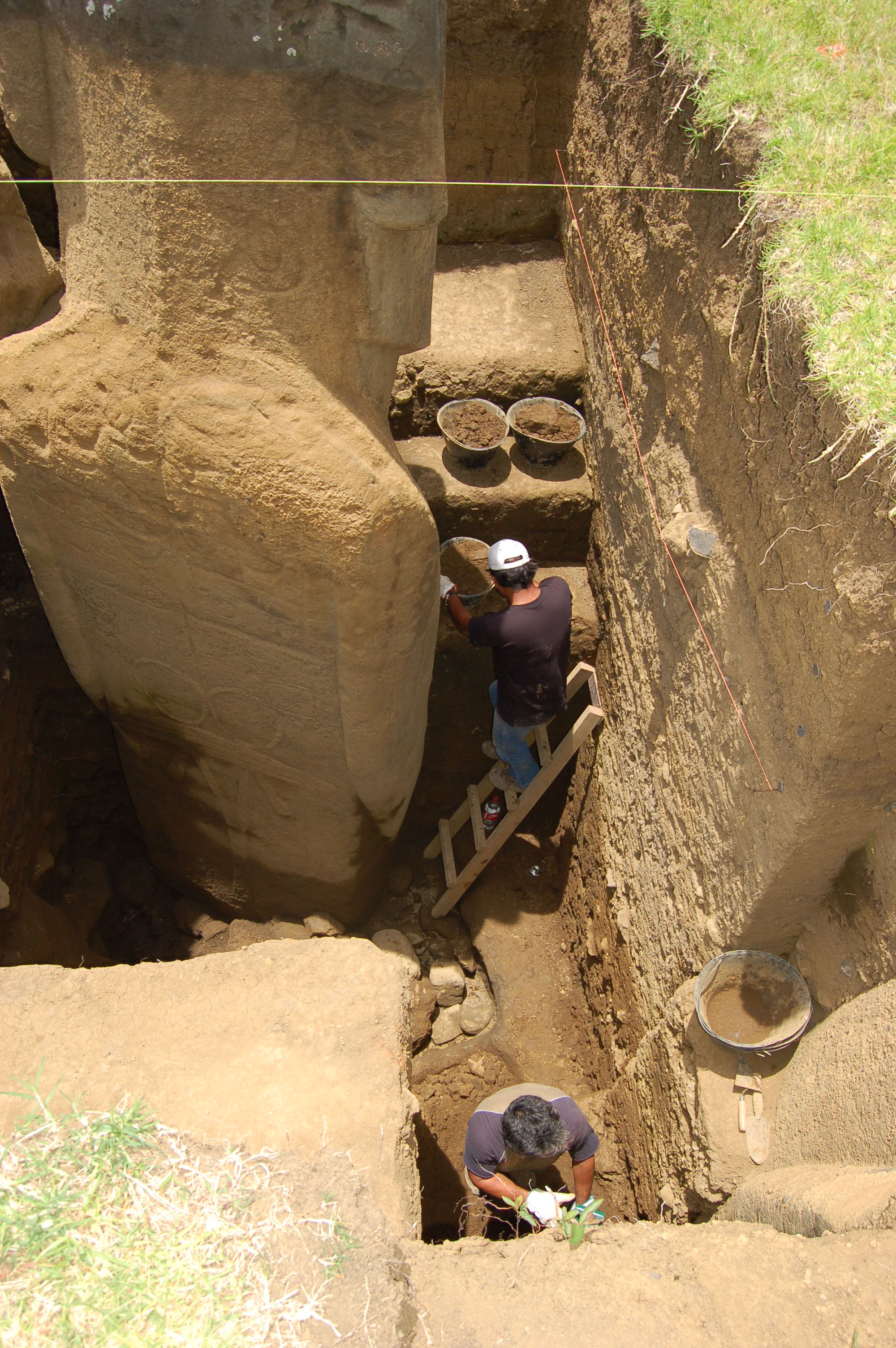
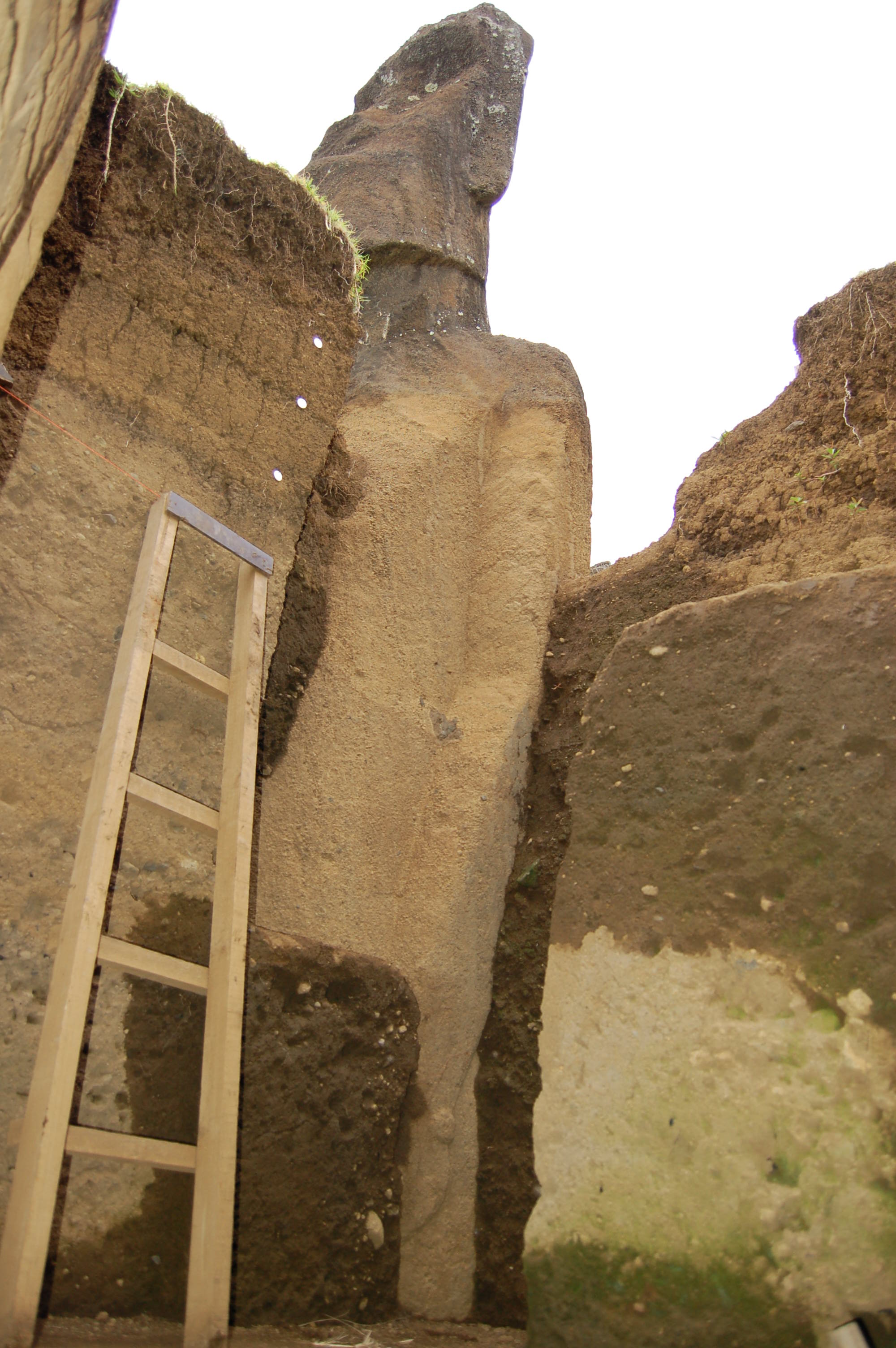
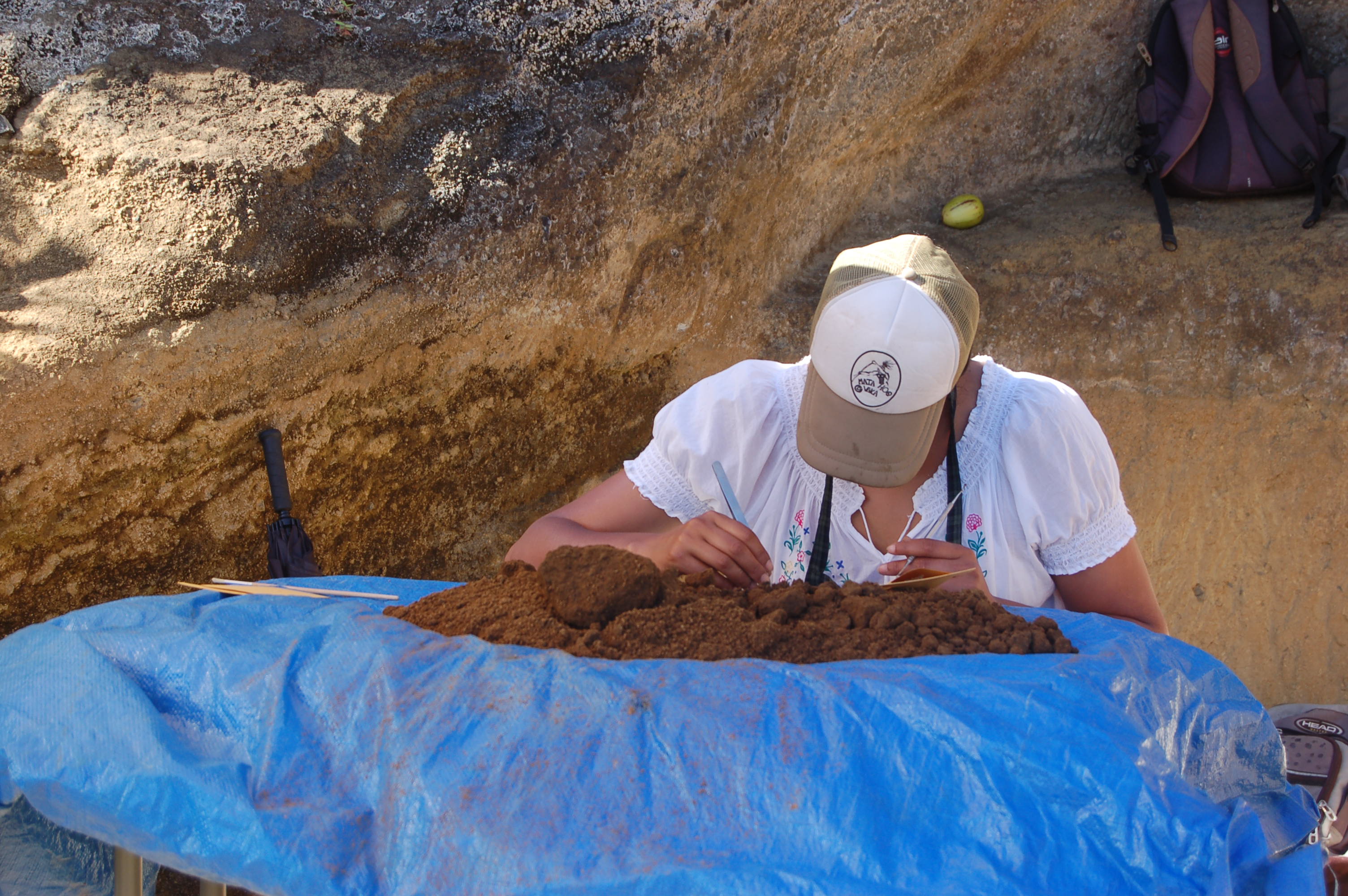
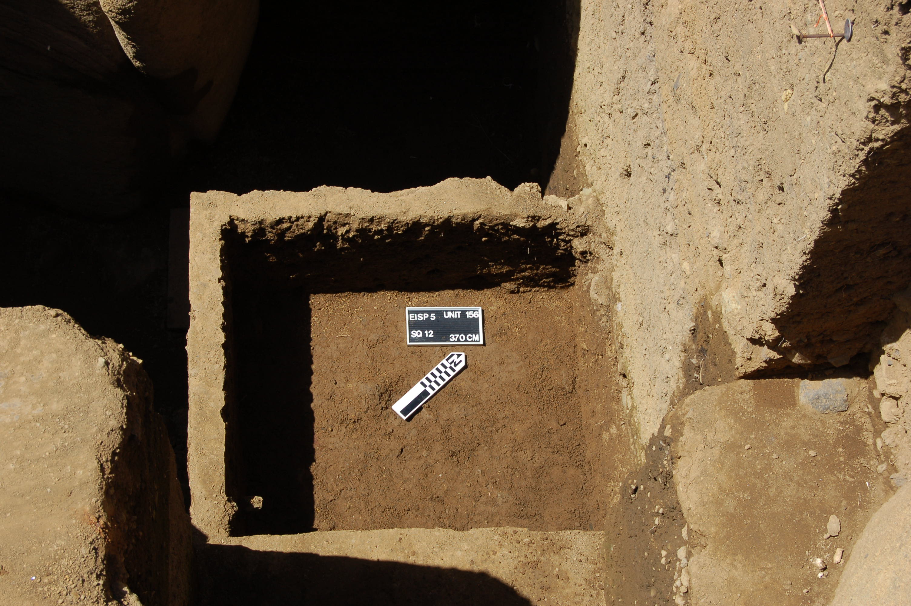
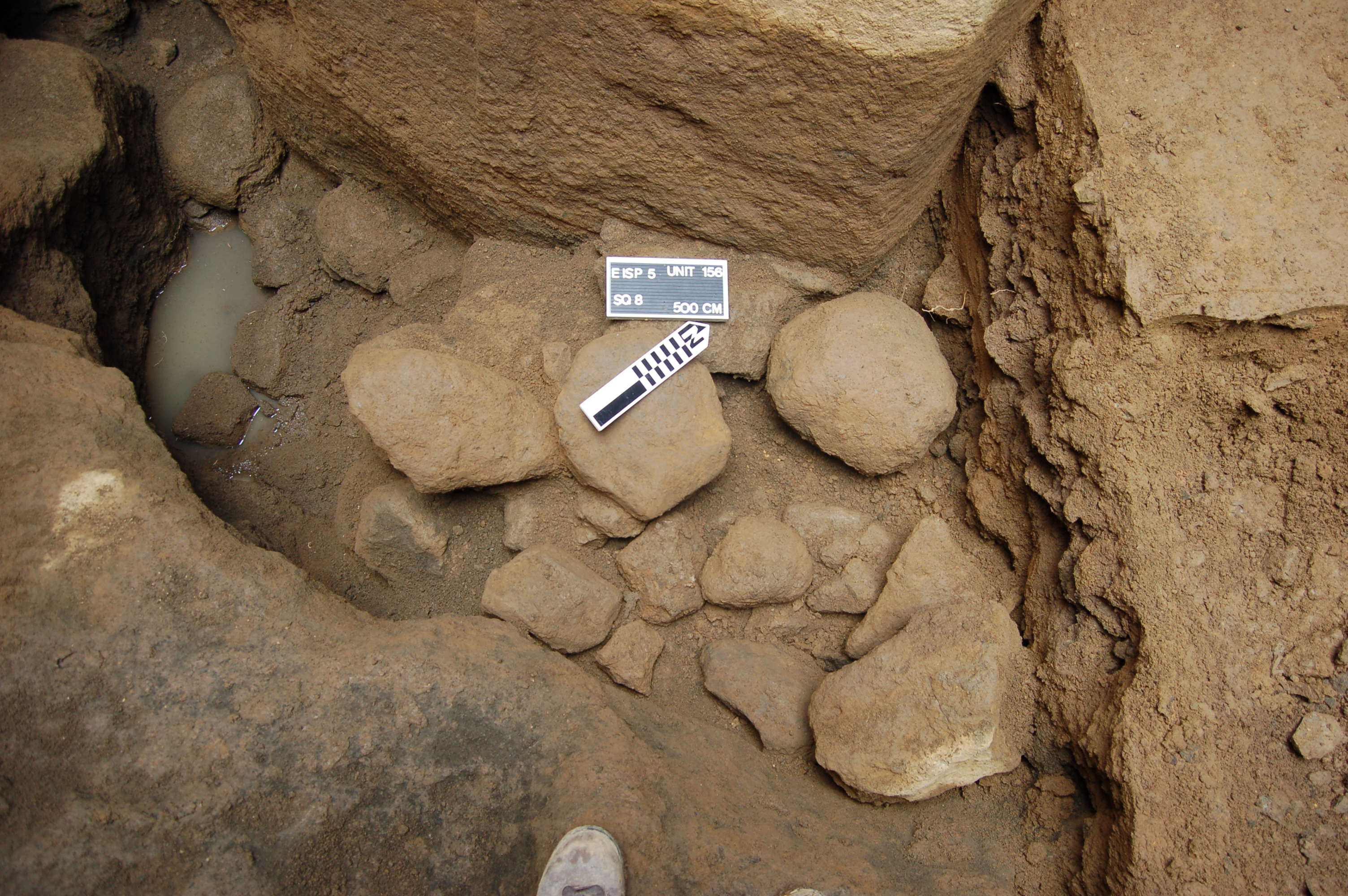
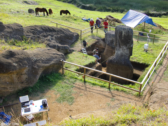
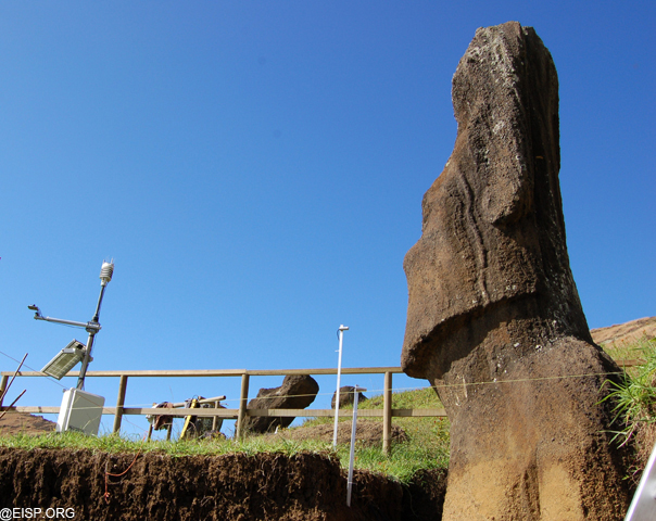
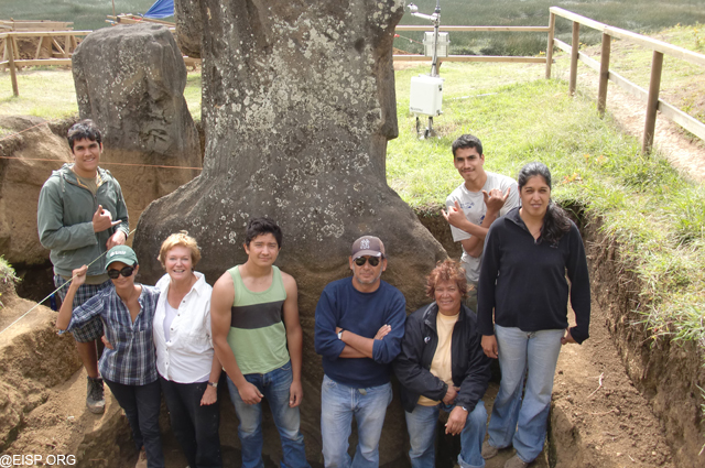
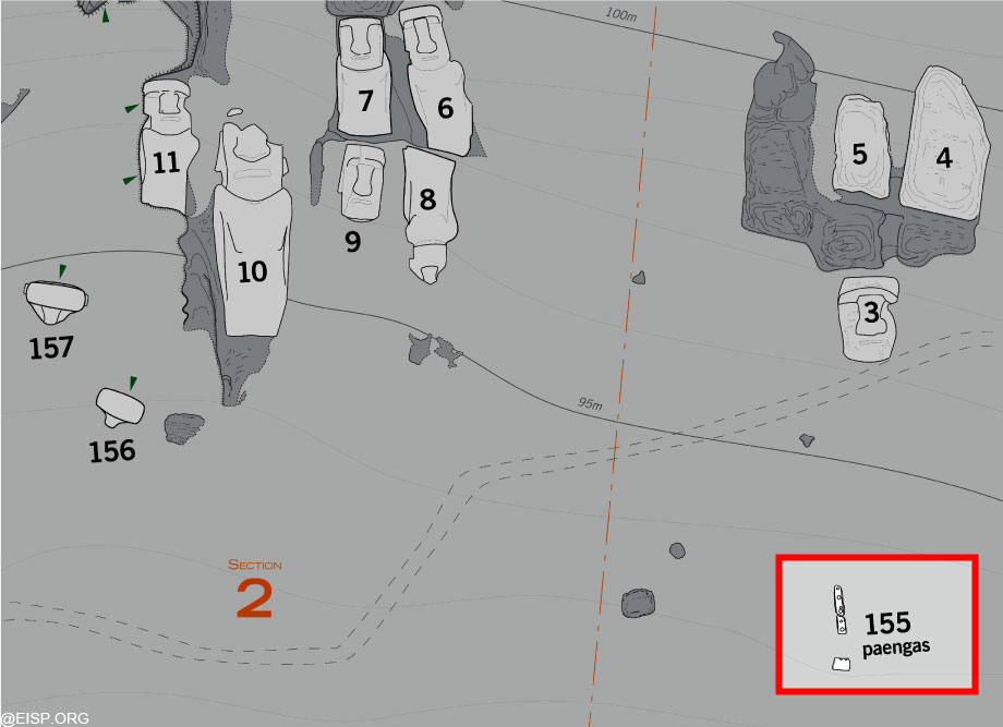
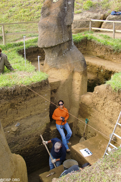
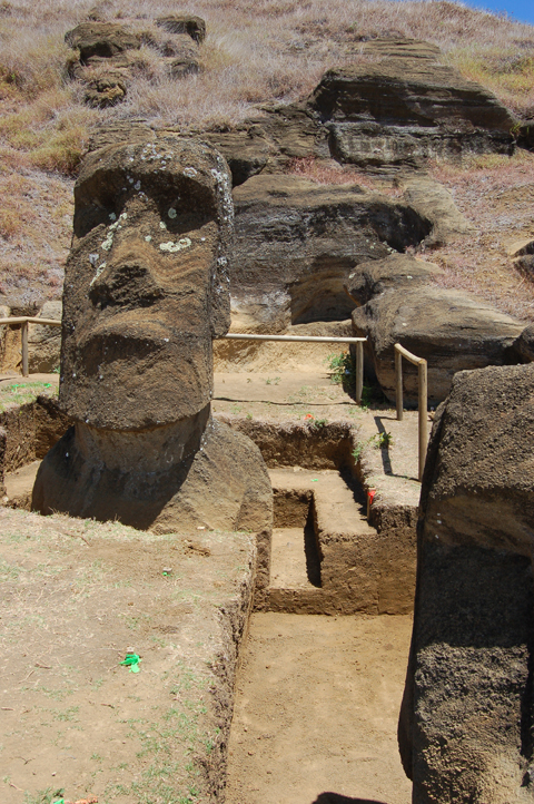
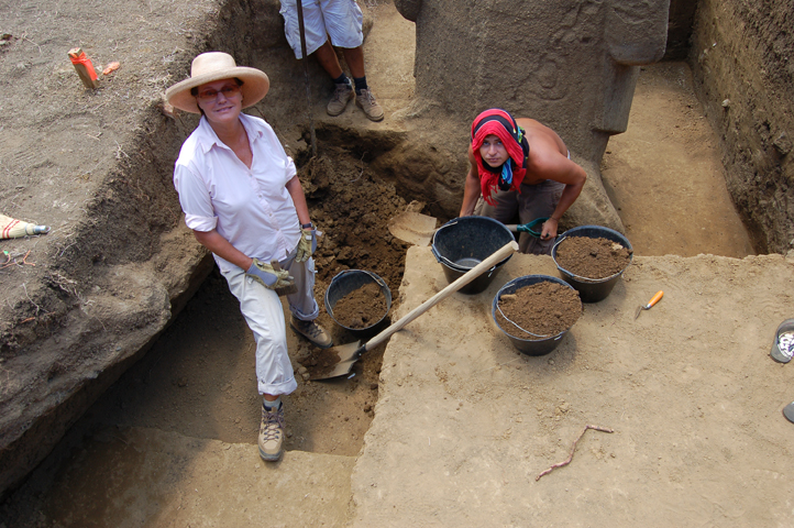
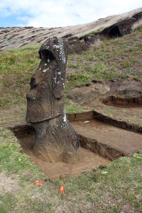
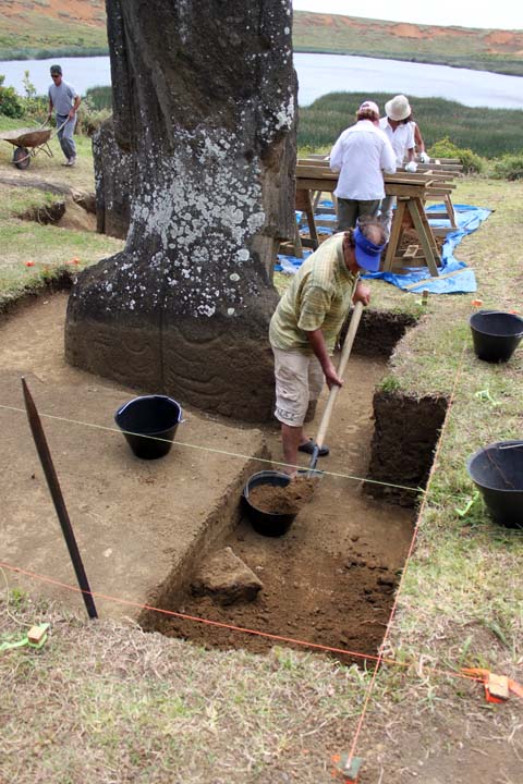
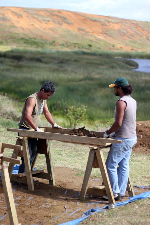
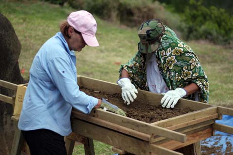
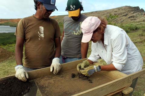
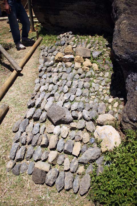
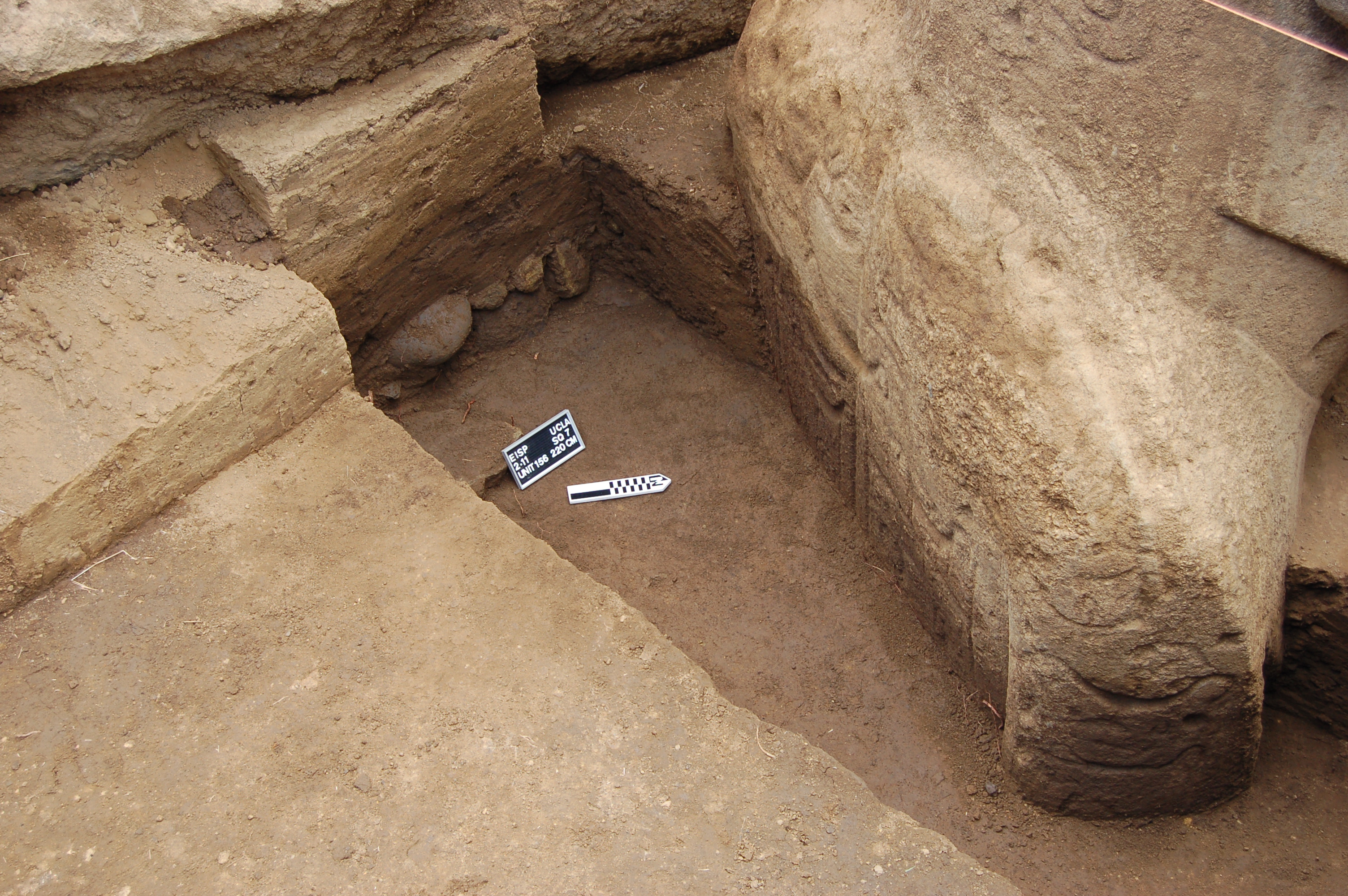
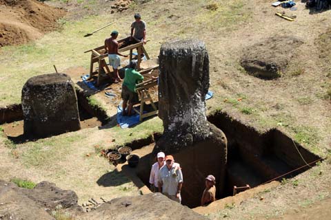
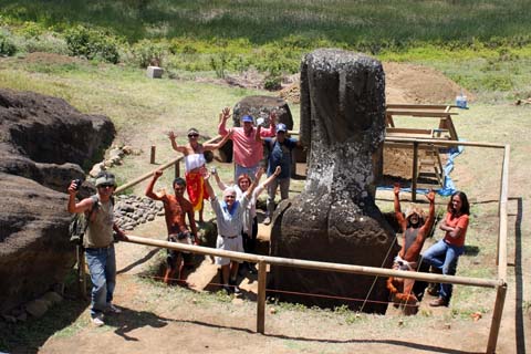
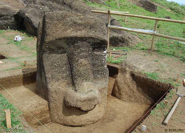
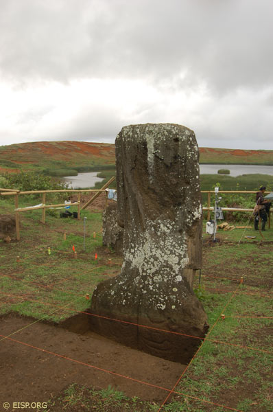
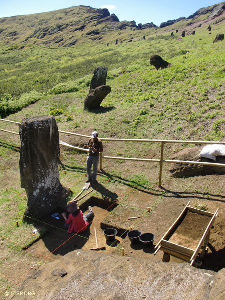
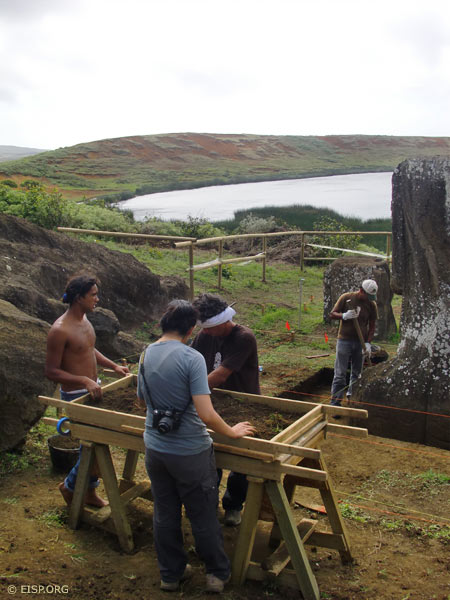
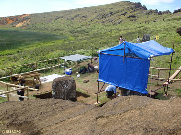
This report is prepared as part of a numbered series that describes the excavations conducted by the Easter Island Statue Project in Rano Raraku Quarry Zone, Interior Region, Quarry 02, Statues RR-001-156 and RR-001-157. The team is composed of an all-Rapanui excavation staff directed by the project Co-directors. With the completion of the conservation and scientific investigations conducted by our Chilean collaborator, Monica Bahamondez P, and our UCLA collaborator Dr. Christian Fischer, we were joined this season by our new Chilean collaborator Sr. José Miguel Ramírez A., Universidad de Valparaíso. Our research agreement is contained in a Memo of Understanding between the Universidad de Valparaíso and the Cotsen Institute of Archaeology at UCLA. This report summarizes our collections and investigations for the period beginning Monday, March 10 and ending Monday, March 14, 2014. This report is part of a preliminary final report that includes some but not all of our in-process laboratory test results and collections analyses, as per our permit CMN ORD 5467-09. A final report will be published in 2015-2016 by the The Cotsen Institute of Archaeology Press.
Phase 2 Season 1
Easter Island Statue Project Phase 2, Season 1
August 2013
Jo Anne Van Tilburg and Cristián Arévalo P.
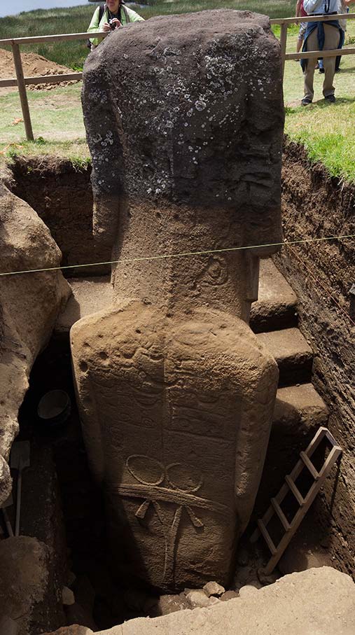
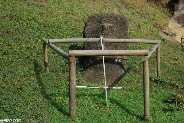
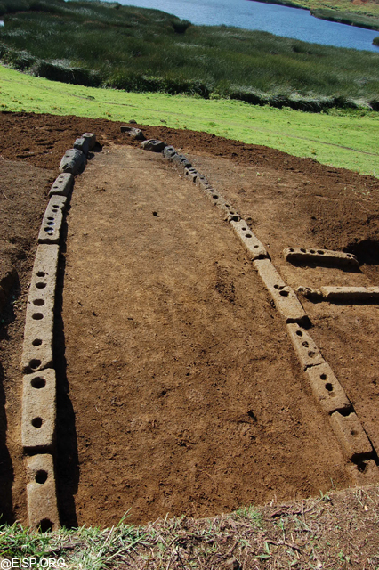
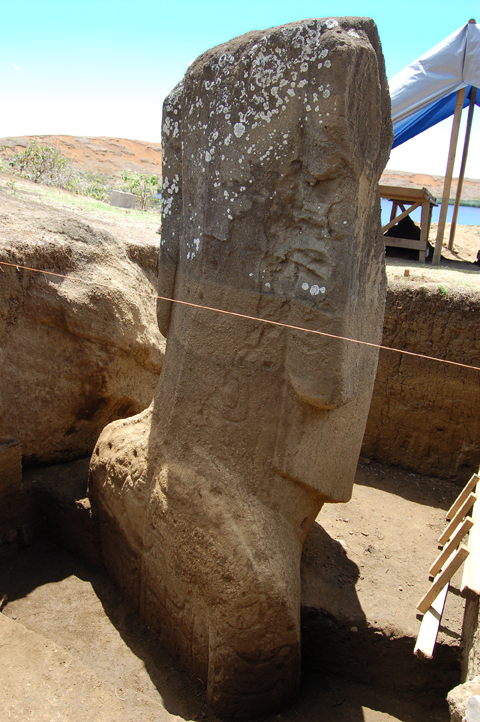
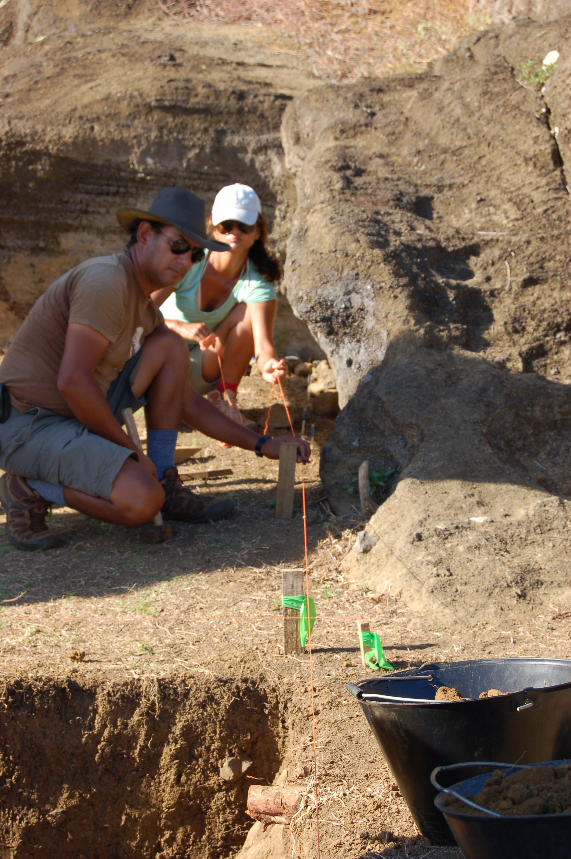
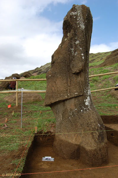
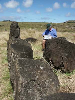
This report describes recent excavations beginning Phase 2 of the project and concentrating on the ventral side of Moai RR-001-156. These excavations are a continuation of limited excavations conducted on the ventral side during Phase 1, which focused on reaching the base of the statue on the dorsal side. The excavation season commenced on August 6, 2013 and actual excavation ended on August 29, 2013. The excavation was subsequently closed to protect it from heavy rains and with the help of personnel from CONAF and CMN.
Phase 1 Season 6
Easter Island Statue Project (EISP) Conservation Initiative
March 2012
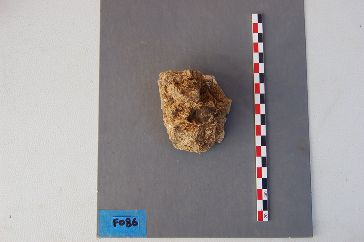
Jo Anne Van Tilburg and Cristián Arévalo Pakarati have accomplished an archaeological survey and inventory of the monolithic stone sculpture (moai) of Rapa Nui. To date, we have accounted for 1,300 monolithic sculptural objects within the island-wide survey sections, in museum collections, and within the Rano Raraku quarry zone, including complete (as opposed to intact) statues, heads, torsos, fragments, shaped block. The latter are considered to be evidence of human activity in the form of incomplete or abandoned projects elucidating energy investment. The most recent object entered into our collaborative on-line database (DATASHARE) is a red stone torso submitted by Enrique Tucki M. of the Oficina Provincial, the Corporación Nacional Forestal (CONAF).
Phase 1 Season 5


Easter Island Statue Project Conservation Initiative
Season V Excavation Summary
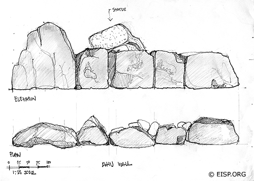
RR-001-156 and Square 4, RR-001-157
Jo Anne Van Tilburg
November 2011
Introduction
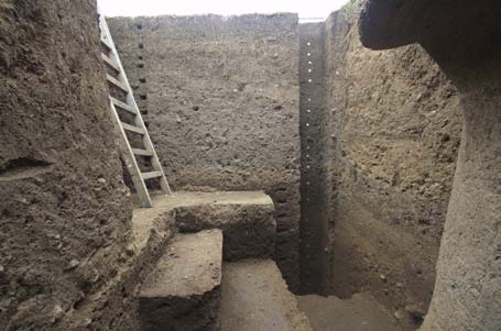
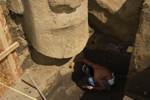
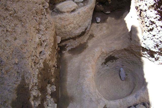
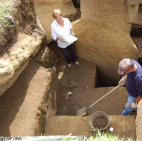
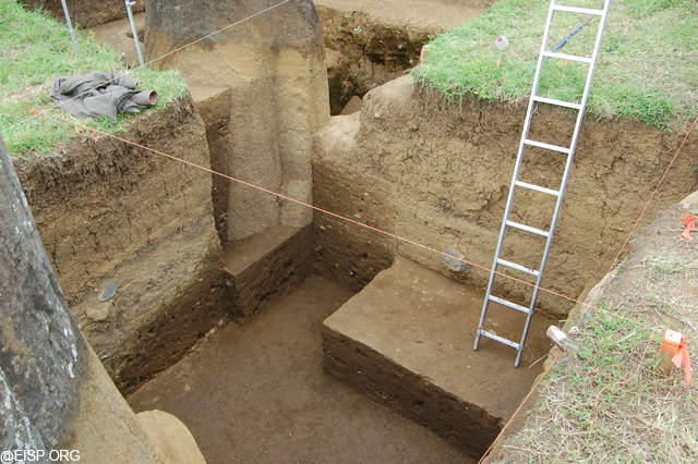
This report is another in a series of reports dealing with the excavation of statues RR-001-156 and RR-001-157 in Rano Raraku quarry, Rapa Nui, Chile. The previous reports were filed with the appropriate Chilean and Rapa Nui agencies and also provided to the general public on the Easter Island Statue Project web site (www.eisp.org). This report deals with the continuing excavation of statue RR-001-156 to the base and Square 4 of RR-001-157. These activities took place during Season V (November 2011) of the Easter Island Statue Project Conservation Initiative.
[Read More…]
Phase 1 Season 4


Easter Island Statue Project Conservation Initiative Preliminary Report
July-August 2011
Project Target Statues
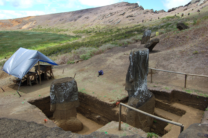
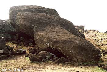
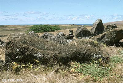
The target statues from the inception of this project are RR-001-156 and RR-001-157, both of which are located within Quarry 2 of Rano Raraku. RR-001-158 is adjacent to Quarry 2 on the eastward side and was selected by the conservators as a study control. All of these designations are given on EISP Map Sheet 1 (Van Tilburg and Arévalo Pakarati 2009). Rano Raraku, the quarry in which fully 95% of the known 1,042 monolithic sculptural objects documented to date by this project were carved, is a unit of the Corporación Nacional Forestal (CONAF; www.conaf.cl) and, as such, a World Heritage site.
Phase 1 Season 3
Easter Island Statue Project Conservation Initiative Preliminary Report
February 2011
Introduction
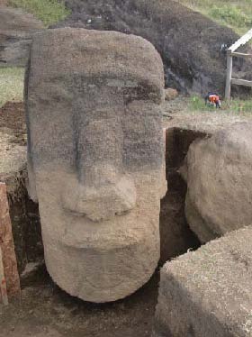
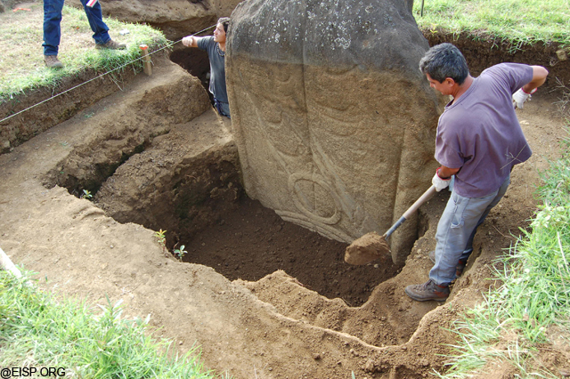
This report is the third in a series documenting the implementation of permitted excavations in Rano Raraku quarry on target statues RR-001-156 and RR-001-157 . Specifically, this report deals with the third excavation season, or Phase 3, and is focused specifically on RR-001-156. The conservation follow-up work that is anticipated for March, 2011 will be conducted by Dr. Christian Fischer and documented by him in a separate report.
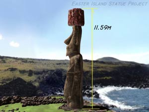
The target statue for this season is RR-001-156. It was previously excavated by the Mana Expedition to Easter Island in 1914-15 (Routledge 1919). According to Routledge’s unpublished notes, “at the start, the statue was buried to a line midway between the lobe of the ear and the angle of the jaw” (NGS/WKR). Two separate excavations, both of which were haphazard and are poorly documented, were made of the dorsal side of the statue. The first excavation reached “to a depth of 16 feet measuring from the crown of the head.” The second excavation at the back was made “to extend the first excavation to 10 feet from the statue back” simply to take photographs. At the front, excavation reached “to the navel.” Our Historic Level Book provides a synopsis of the excavations and the objects collected.
Phase 1 Season 2
Easter Island Statue Project Conservation Initiative Preliminary Report October-November 2010
Introduction
This report is a preliminary statement of the tasks undertaken and goals achieved during the second field season of Phase 2 of the Easter Island Statue Project Conservation Initiative. Phase 1 took place in April, 2010 and a full report of that work is on file with the appropriate agencies. This report is a detailed overview but not a final, scientific analysis or synthesis of our findings. That will be produced at the end of the combined work planned for Phase 3 and Phase 4, which entails the similar excavation and study of Moai RR-001-156.
The Conservation Initiative is funded by the Archaeological Institute of America, and its intent is a scientific evaluation of the state of preservation, above and below ground, of the two statues described here (RR-001-156 and RR-001-157). In addition, the Conservation Initiative will monitor and collect scientific data on the discrete environmental contexts of the two statues. These data will be employed to determine the course of stone stabilization treatment to be embarked upon for each statue, and how that treatment may or may not be generalized to other statues.
Phase 1 Season 1
Easter Island Statue Project Conservation Initiative Preliminary Report March-April, 2010
Introduction
This project is the first controlled, scientific archaeological excavations ever undertaken in the interior of Rano Raraku Quarry. It is also the first stone conservation and preservation pilot program in Rano Raraku.
All but one of the 22 standing statues (moai) in Rano Raraku Quarry interior have been previously exposed through unscientific and undocumented digging. The Target Statues for this project (RR-001-156 and RR-001-157) have been dug or otherwise disturbed by the Mana Expedition (1914), the Franco-Belgian Expedition (1935), and the Norwegian Archaeological Expedition (1954-55).
The Easter Island Statue Project (EISP) has a 20 year history of archaeological survey on Easter Island (Rapa Nui), the objective of which is the creation of a full and complete, island-wide monolithic and portable statue inventory and the compilation of an historical image record for each statue. Prior to the selection of Quarry Two for the excavations described here, the EISP team completed a five year mapping foray in the interior of Rano Raraku, the volcanic quarry from which 95 percent of the extant monolithic sculpture were produced (Van Tilburg 1994; Van Tilburg, Arévalo Pakarati and Alice Hom 2008).
[Read More…]
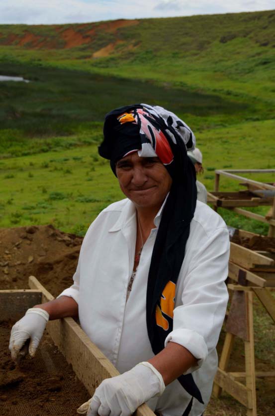
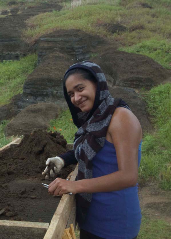
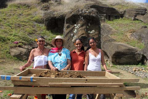
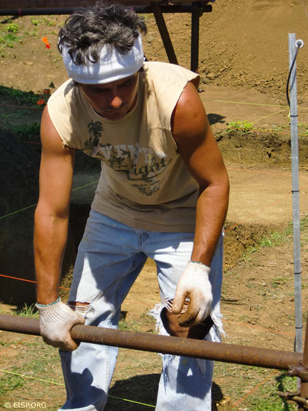
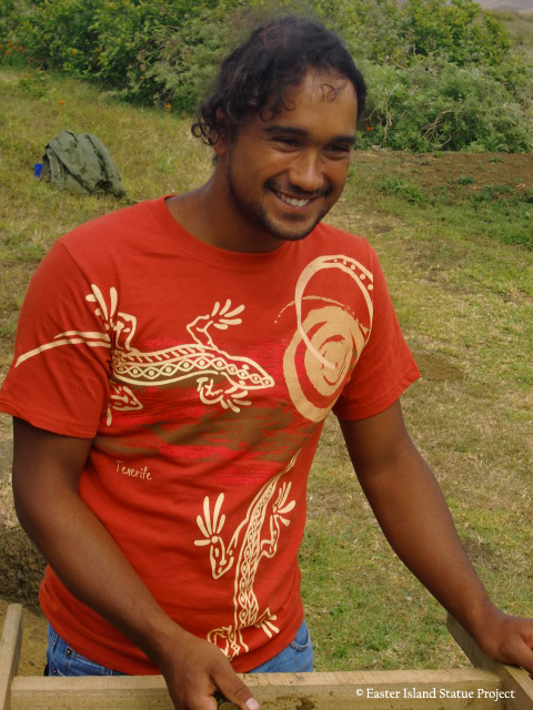
Meet our EISP Excavation Crew!
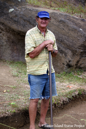
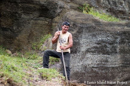
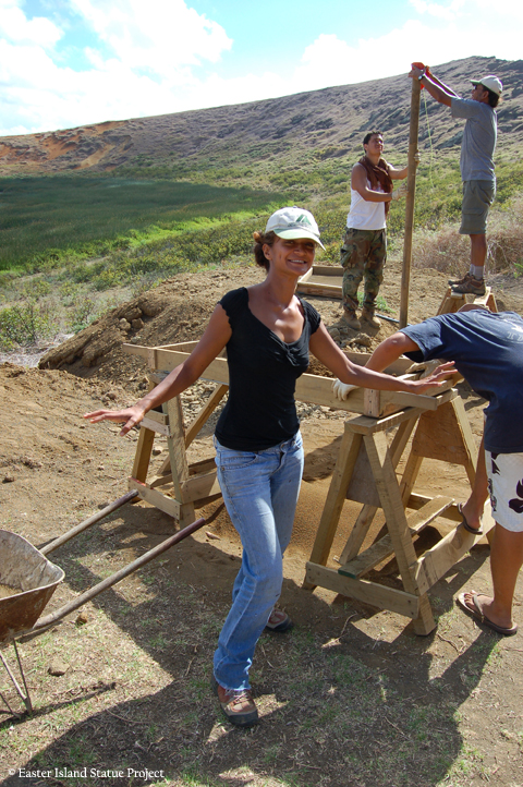
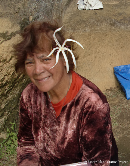
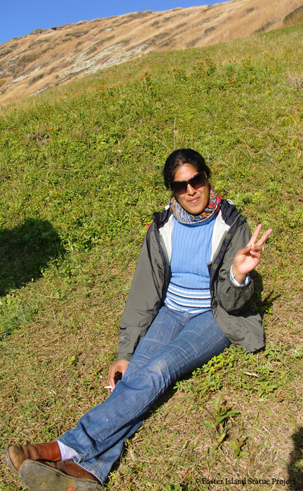
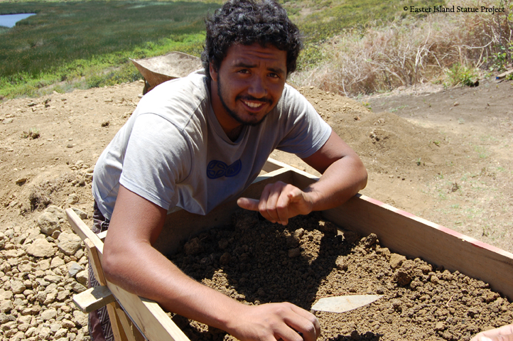
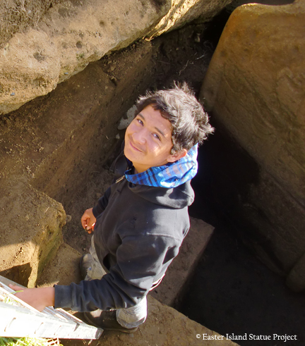
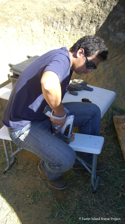
Jo Anne Van Tilburg and Cristián Arévalo Pakarati lead an all-Rapa Nui crew and core staff consisting of Dario Ika Paoa, excavator; Patricio Rodrigo Madariaga Paoa, excavator; Vaiheri Tuki Haoa, photographer; and Rosa Lucía Ika Paoaand Anastasia Ika Paoa, logistics and support.
We have been joined seasonally by Carlos Rapu Rapu, Benjamin Mihaore Pakarati González, Ana Pakarati Icka, Margarita Pakarati, and Melisanda Pakarati;
Rapa Nui students in archaeology and conservation, some of whom are from Universidad Internacional SEK, include Isaías Hey Gonzáles, Joaquin Soler Hotu, Rafael Paoa Rapu, Tiktehatu Astete Paoa and Felipé Rubio Munita.
Dr. Christian Fischer and Mónica Bahamondez Prieto are in charge of the conservation initiative of our AIA-funded project, with Paula Valenzuela and Tahira Edmunds on field data collection.
EISP staff who have worked on the excavation include Alice Hom (2010) and Kim Anh Hoang (2011).
Volunteers include Tokerau Pakarati Icka, Hotu Pakarati Icka, and Johannes Van Tilburg, FAIA. CONAF employees, especially Pablo Hito, have all been present or involved at one time or another.
Join Us in a Monumental Task
Save the Easter Island Statues
Dear Friends,
Through a methodical archaeological survey we have accomplished the digital mapping of Rano Raraku statue quarry, documented over one thousand statues throughout the entire island and created the world’s largest archaeological archive describing the statues.
Working with scientific colleagues at The Cotsen Institute of Archaeology at UCLA and with conservators from Chile’s Centro Nacional de Conservación y Restauración. We are excavating and conserving statues in Rano Raraku interior quarry. Knowledge gained there will allow preservation of other statues throughout the island.
In 2008, our work was rewarded with a grant from the Site Preservation Task Force of the Archaeological Institute of America (AIA; www.archaeological.org).
A wonderful AIA grant jumpstarted our conservation initiative. EISP has no endowment. Our only source of income is grants and U.S. tax deductible contributions.
Please join us in A Monumental Task, become a Friend of EISP!
—Jo Anne Van Tilburg
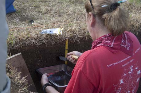
Conservation Report Season II
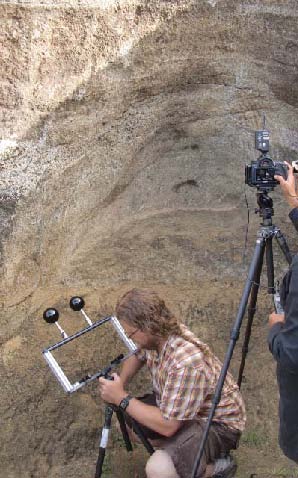
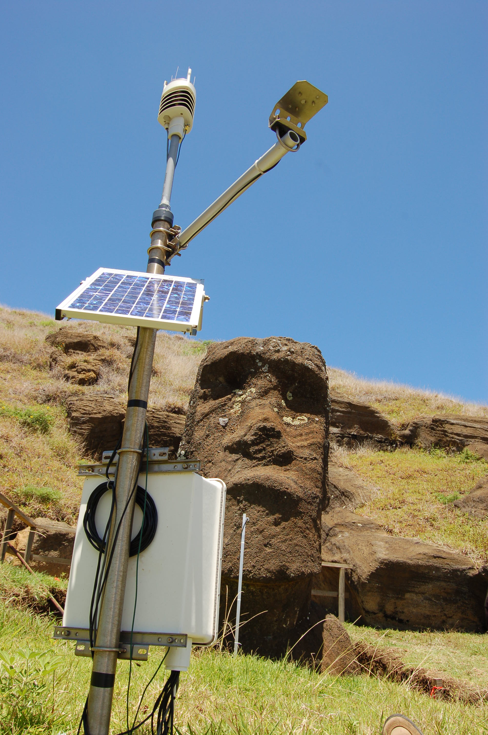
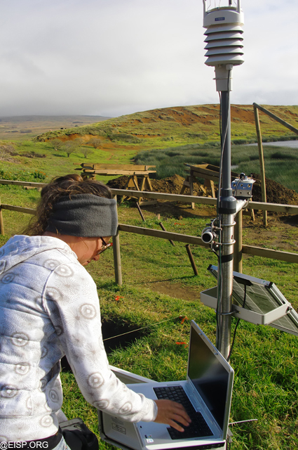
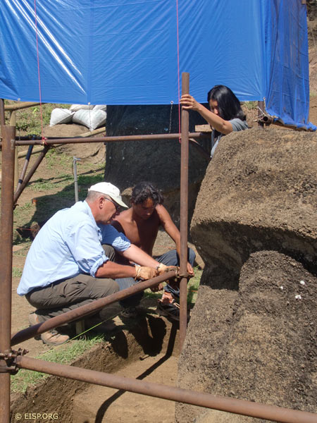
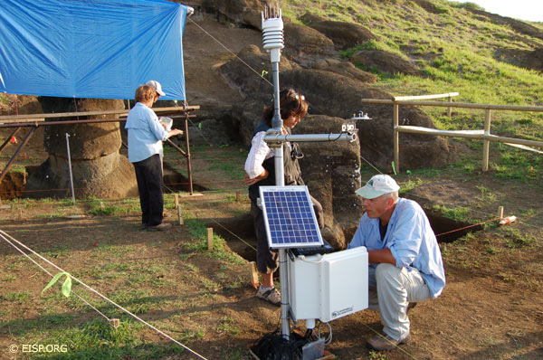
Environmental Monitoring and Conservation Mission
Dr. Christian Fischer and Ms. Monica Bahamondez P.
May 14-26, 2011
Introduction
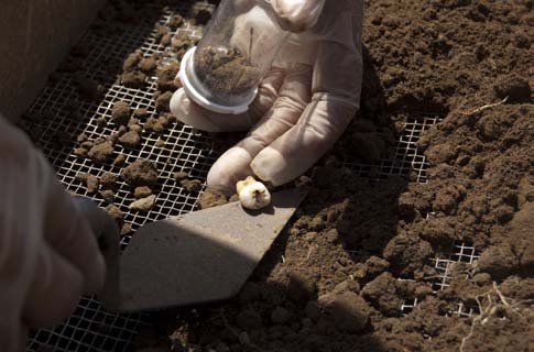
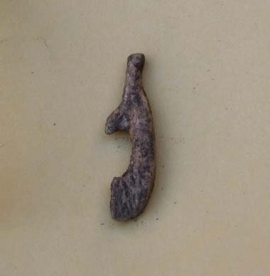
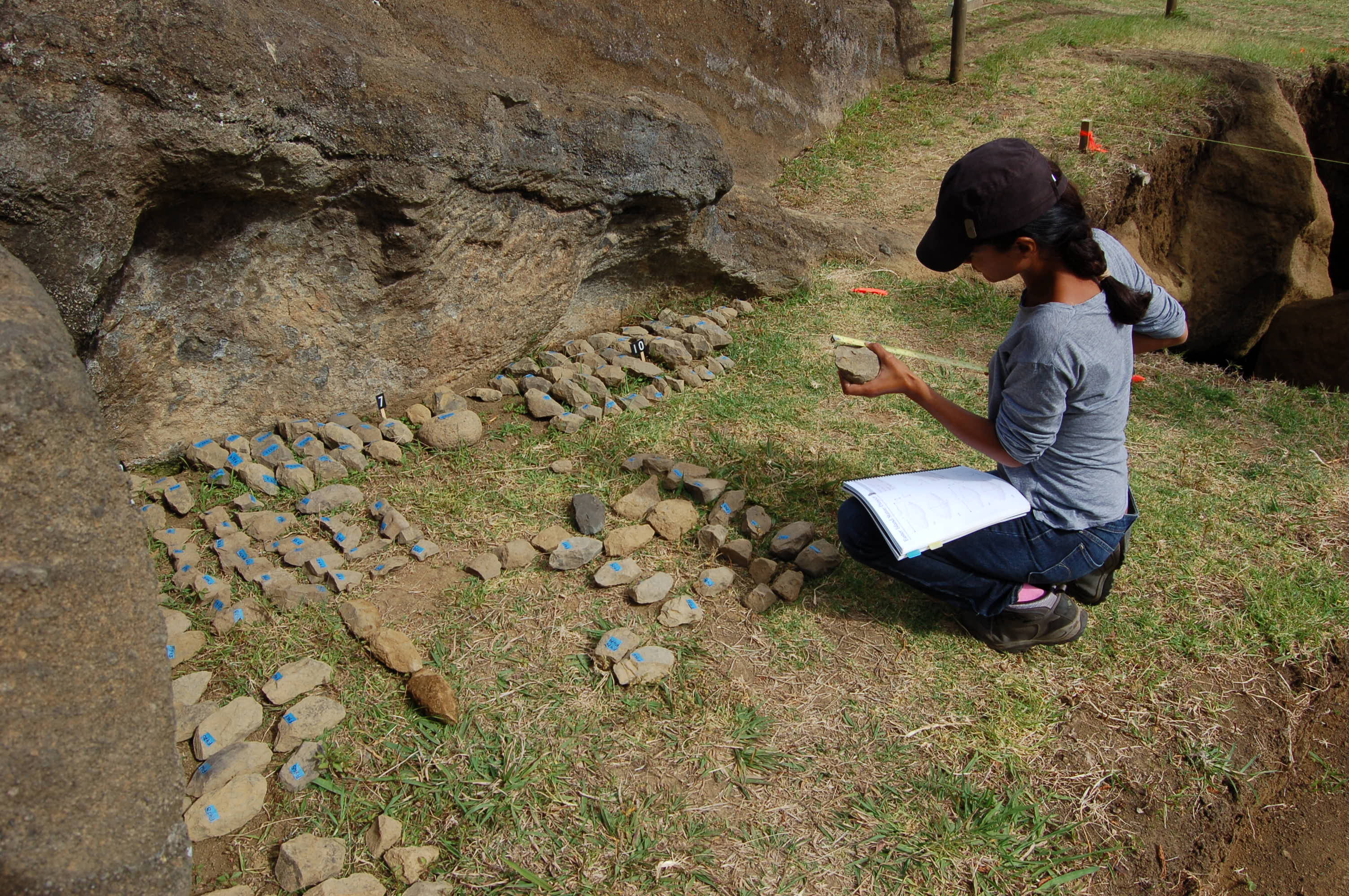
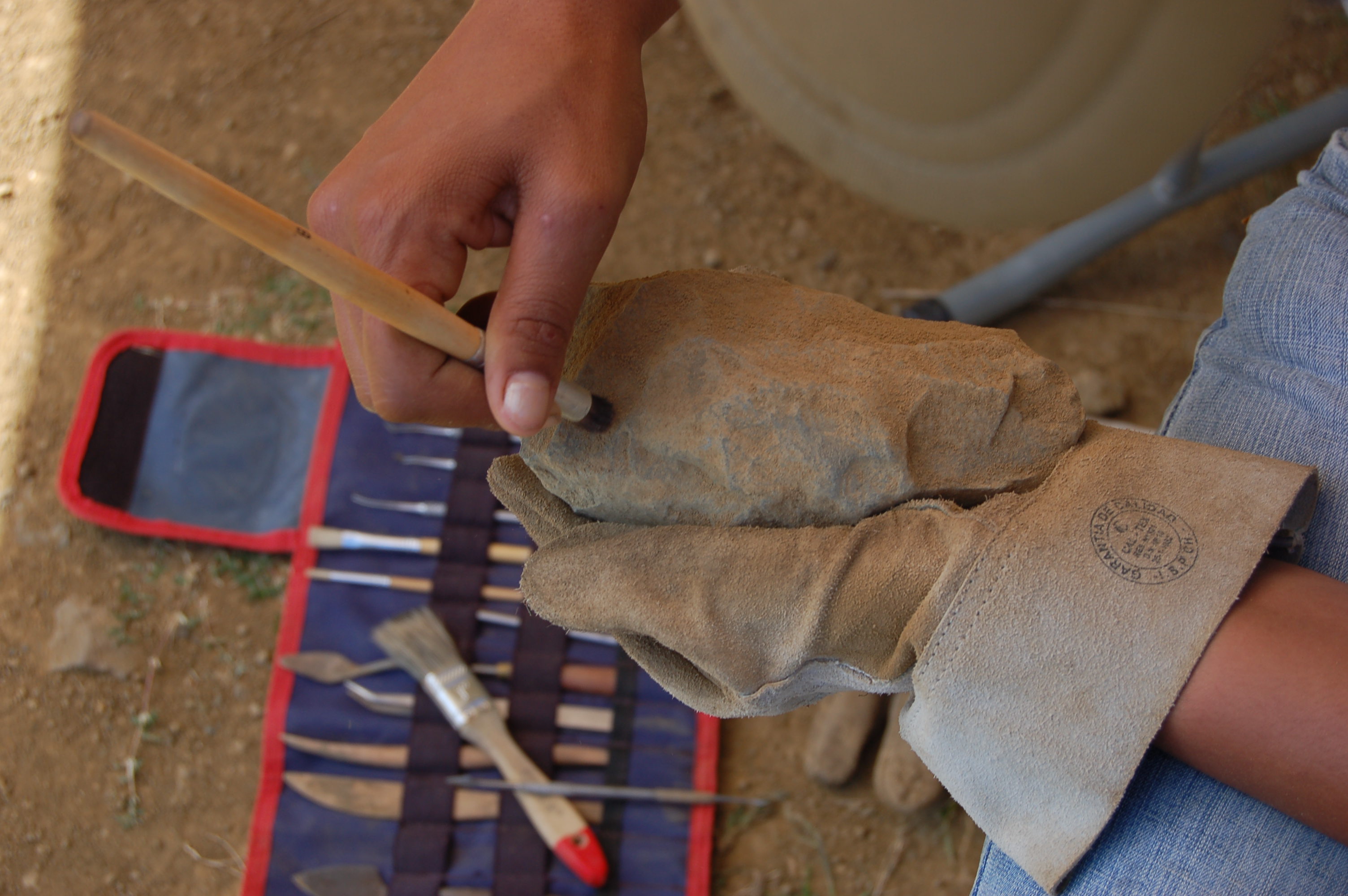
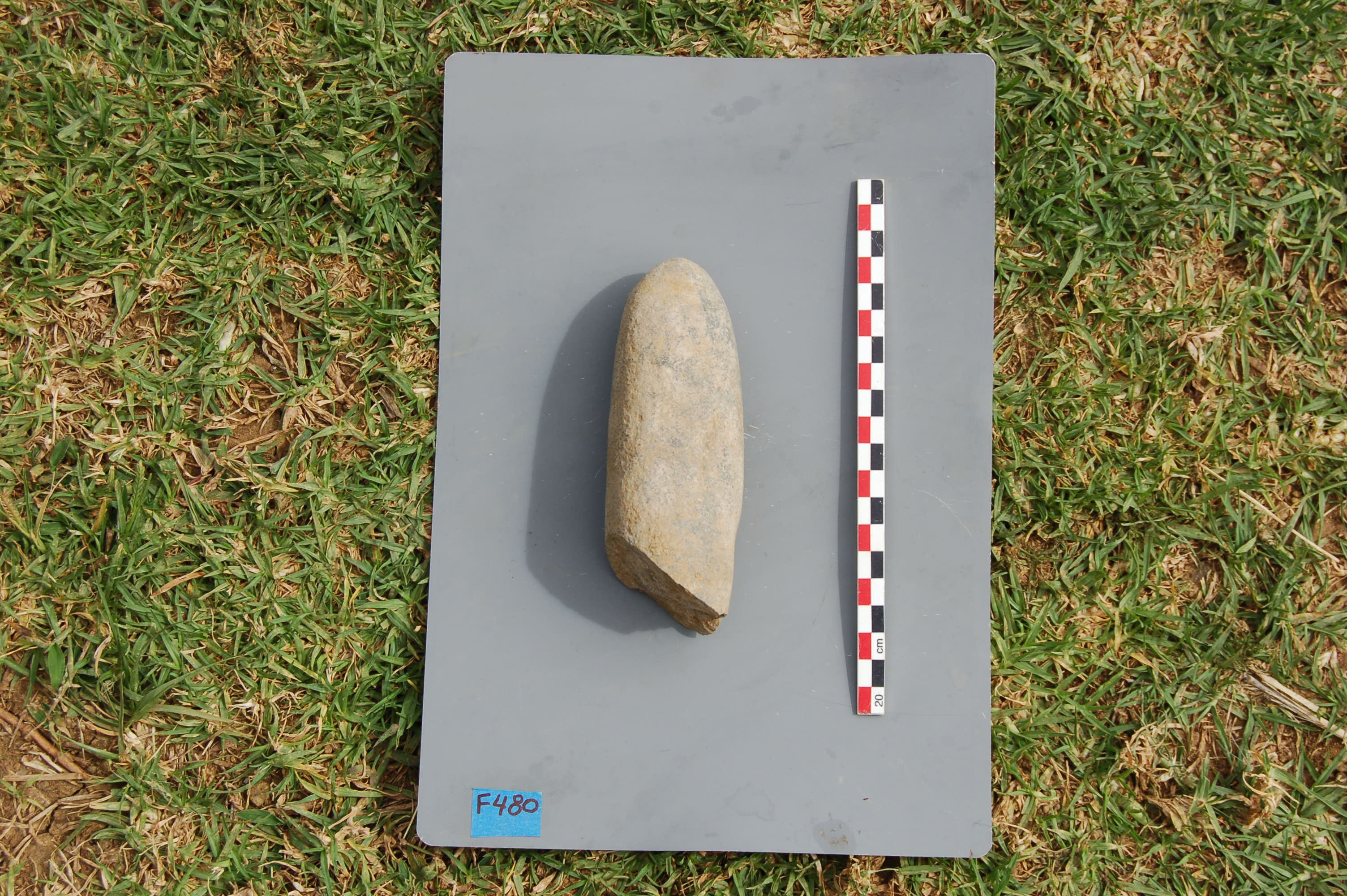
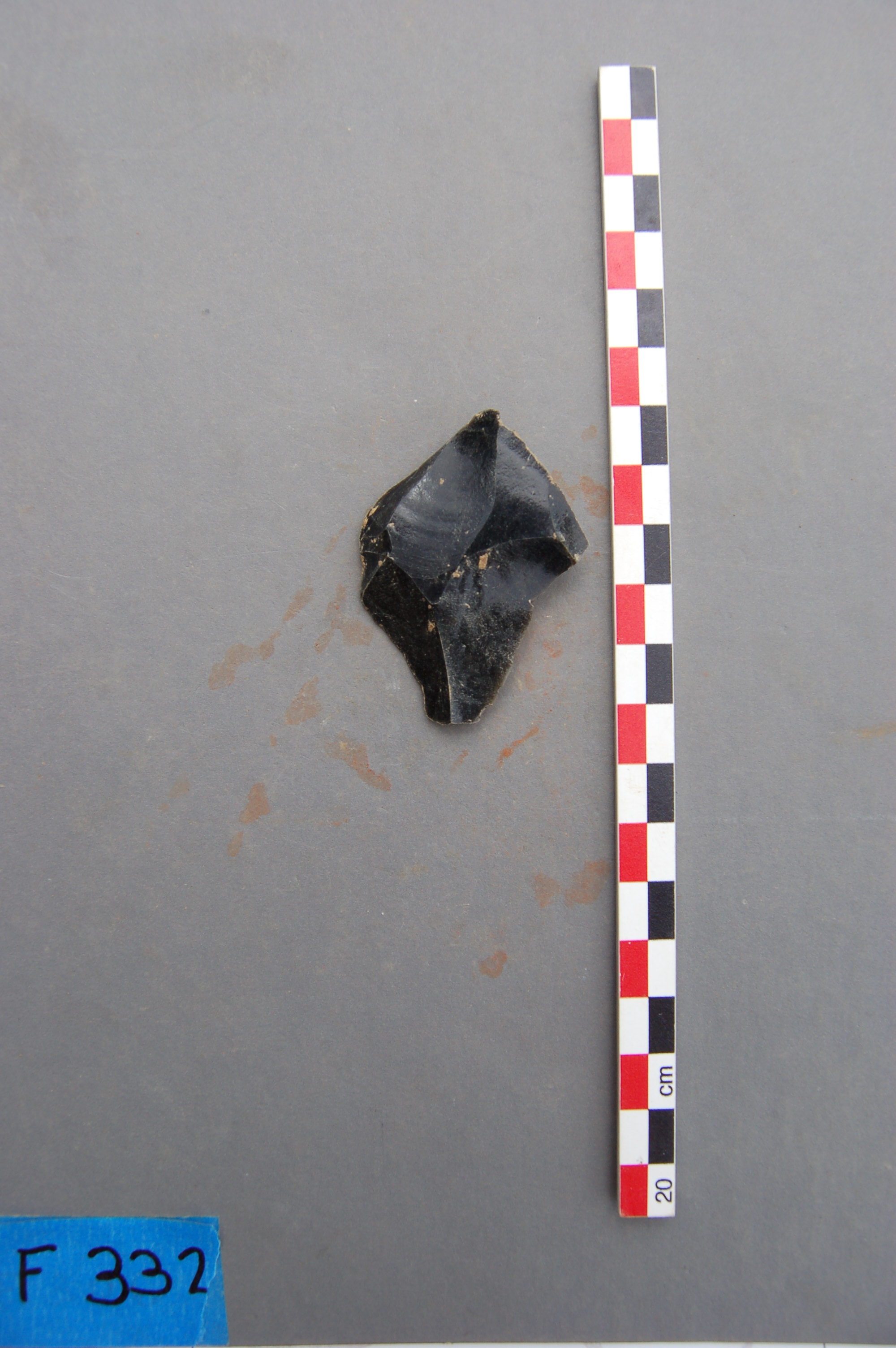
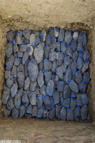
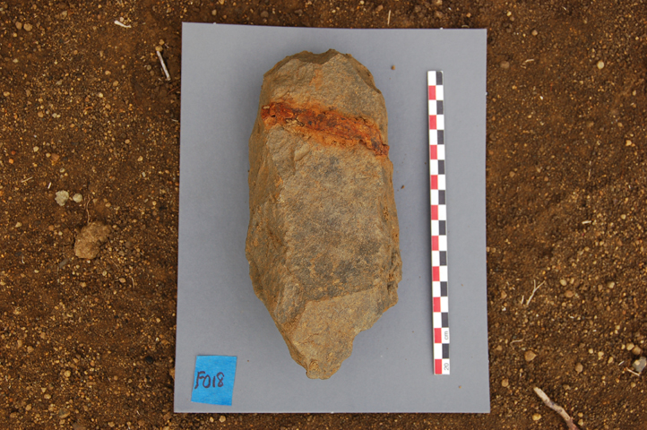
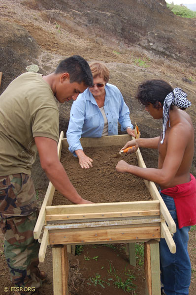
The main objectives of this mission, carried out with the assistance of Cristián Arévalo Pakarati, Rafael Paoa Rapu and Vaiheri Tuki Haoa, were firstly, to apply the protective treatment on statues RR-001-157 and RR-001-156 currently being excavated by EISP and secondly, to start the Toki Sourcing Project by analyzing the elemental composition of the ‘toki’ found during the excavation using a portable X-ray fluorescence spectrometer.
Conservation Report Season I
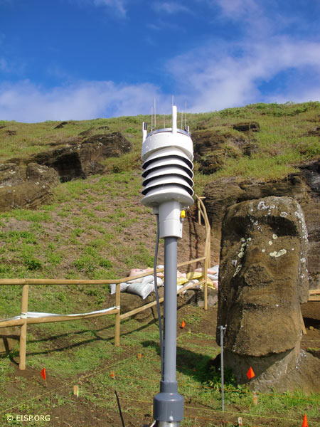
Environmental Monitoring and Conservation Mission
Dr. Christian Fischer and Ms. Monica Bahamondez P.
March 8-16, 2011
Introduction
The main objective of this mission, carried out with the assistance of Cristián Arévalo Pakarati, was to evaluate the status of the environmental monitoring equipment illegally removed in 2010 and to re-install it on site for a measurement campaign of seven months to November 2011. In addition, another objective was to complete the building of the fence on the site to ensure safety around both equipment and excavated areas and to avoid potential damage from cattle and horses. Finally, a few meetings in relation to the project were also organized with different people on the island.
AIA Conservation Project Reconnaissance
Field Work
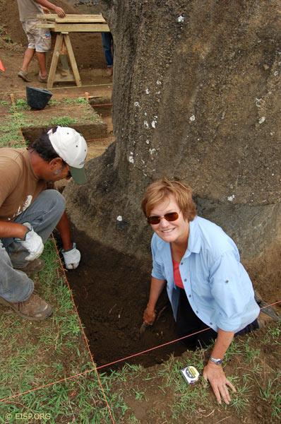
In June, 2009, Christian Fischer, Research Associate of the Cotsen Institute of Archaeology, UCLA and Mónica Bahamondez P., Centro Nacional de Conservación y Restauración joined Jo Anne Van Tilburg and Cristián Arévalo Pakarati (of EISP) in the field on Rapa Nui. Our immediate goal was a fact-finding and reconnaissance field study that would acquaint our colleagues on the AIA Project with the island sites and objects that are target concerns of our upcoming conservation work.

Christian Fischer, Mónica Bahamondez P. and Jo Anne Van Tilburg in the Rano Raraku quarry with statues 'Mama' and 'Papa.'
In the interior of Rano Raraku quarry, EISP has mapped and documented every statue in each of their various carving phases, as well as the independent histories of the individual quarries. Two statues, famously dubbed “Papa” and “Mama” by Katherine Pease Routledge, co-leader of the Mana Expedition to Easter Island, 1919, were the immediate focus of our attention. We studied specific issues of stone faulting and breakage, and planned a strategy for environmental monitoring, which will be carried out during 2009-2010. [Read More…]
Hoa Hakananai’a Laser Scan Project
September 2007
Background, Rationale and Goals

Laser scannning Hoa Hakananai’a at the British Museum. Photo by J. Van Tilburg.
To date, Van Tilburg and the Easter Island Statue Project (EISP) have inventoried 887 monolithic statues (moai) and compiled a metric database buttressed by 24,000 original and archived images. Some 35% of the known statues are located on or in direct relation to ceremonial sites called image ahu (Martinsson – Wallin 1994: Appendix 1 gives 164 image ahu; Van Tilburg 1986; Van Tilburg and Vargas C. 1998).
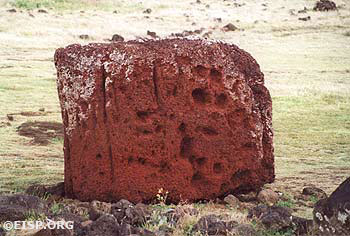
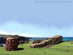
Rano Raraku, a volcanic crater on the island’s eastern plain, was the source of the sideromelane (basaltic) tuff from which 95% of the statues were carved. This source is irrefutable as there are 397 in situ statues, of which 141 in various stages of completion have recently been mapped by EISP in the interior quarries (Van Tilburg 2005; www.eisp.org). Much rarer statue lithologies are basalt (hawaiite lavas) from three named regions; trachyte and ‘red basaltic scoria’ or ‘red scoriaceous lava’ (also used as pukao or ‘topknots’ that were placed on the heads of about 75-100 statues).
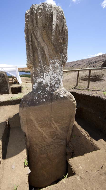
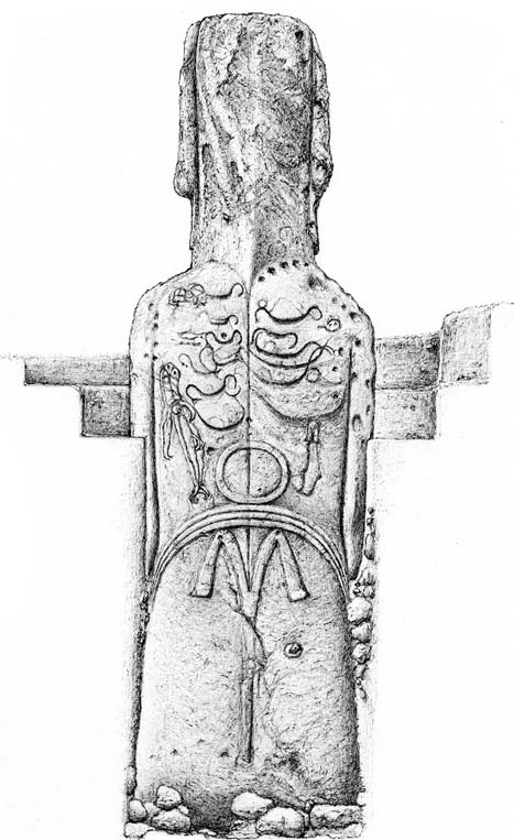
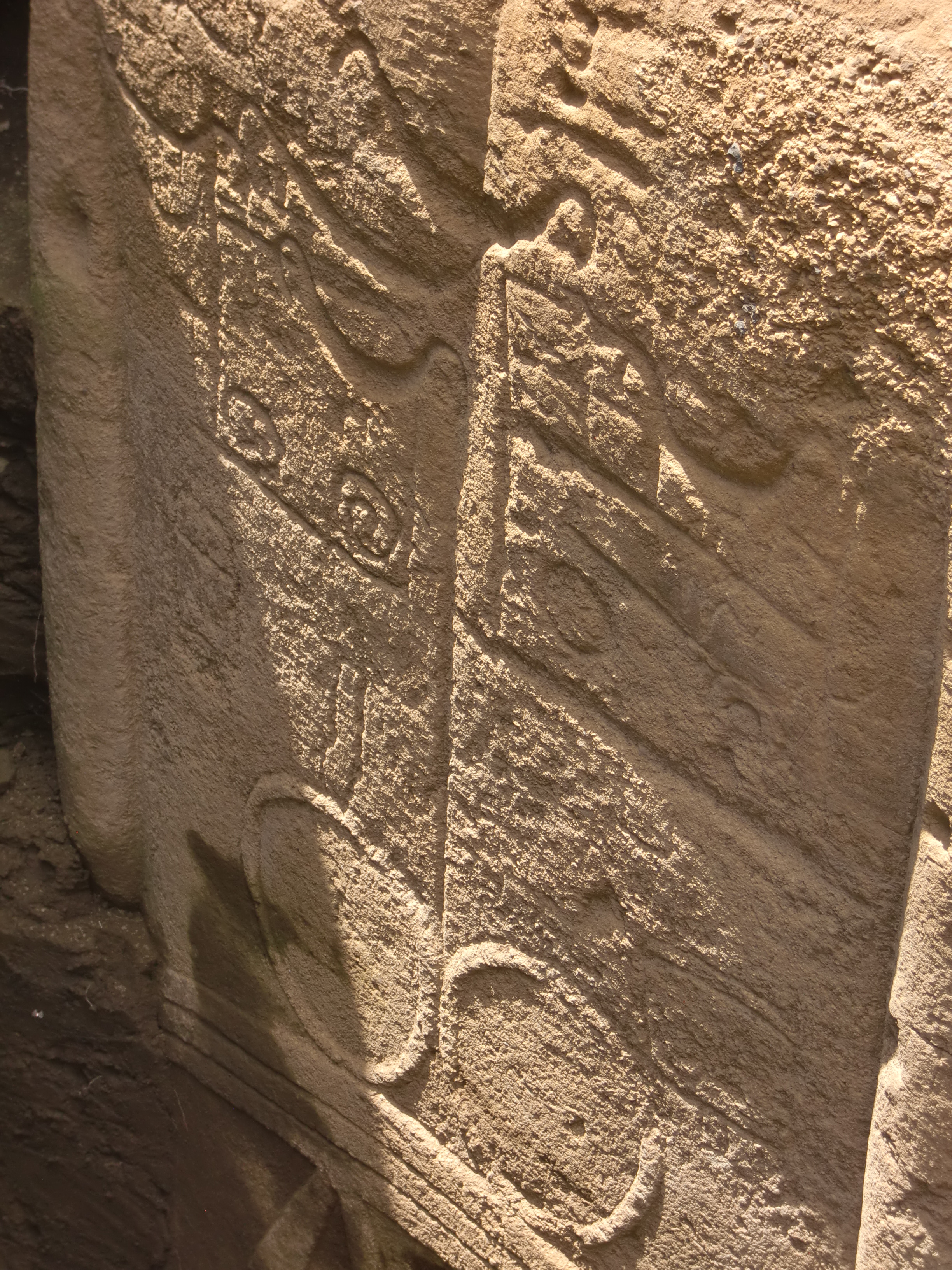
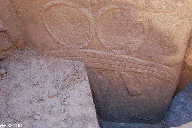
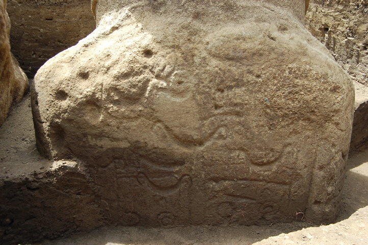
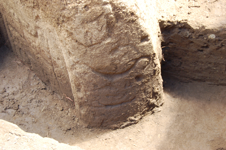
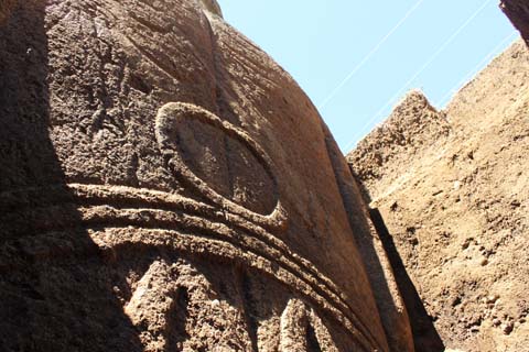
There are only 20 statues (portable and non-portable) now in the EISP database which were carved of basalt. Of these, 7 are in museum collections. The British Museum holds two basalt statues, both of which are of central and very great significance to furthering our understanding of Rapa Nui history. One of them (1869.10-5.1) is re-carved on its dorsal side with bas-relief and incised petroglyphs of great iconographic significance. This re-carving is unique in its style, detail, and expertise and quality of execution. Four other statues, including 1869.10-6.1 (Moai Hava), have incised petroglyphs of lesser distinction but within clearly defined, limited typological categories. Another 30 statues still in situ on the island have applied decorations of similar styles.
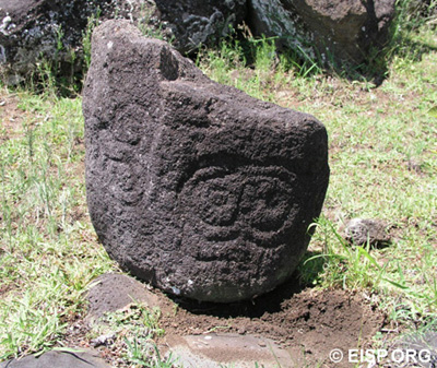
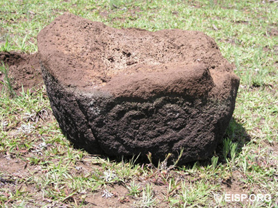
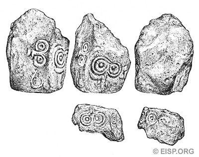
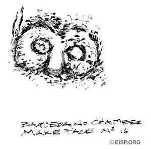
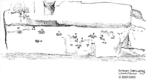
Makemake Rock Art Motifs
Statues Along Transport Roads


In 2006-2007, EISP resurveyed the statues along the “transport roads” and updated the visual documentation record for each statue. This new data was used to create a more accurate map that shows unique statue details.
Moai Paro Digital Reconstruction
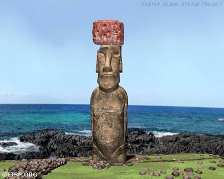
Moai Paro (30-220-001) is the tallest (989 cm) statue ever successfully raised upright on a ceremonial platform. It weighs approximately 82 m tons and wore a red scoria pukao (30-220-004) that added another 11-12 m tons of weight to the statue. Previously investigated by C. Smith and W. Mulloy, we documented it first in 1984 and 1991.
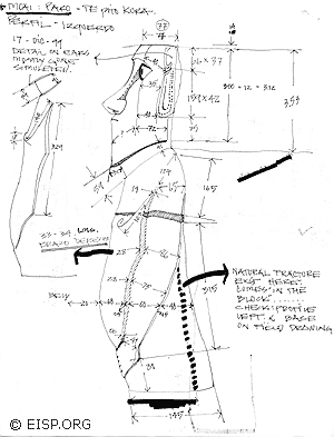
In an effort to better understand Moai Paro in the context of Ahu Te Pito Kura and its natural environs, in 1999 and 2000-2002 we digitally reconstructed the statue using photographs, measurements and detailed drawings. On-site documentation required for this work was carried out by Cristián Arévalo Pakarati.
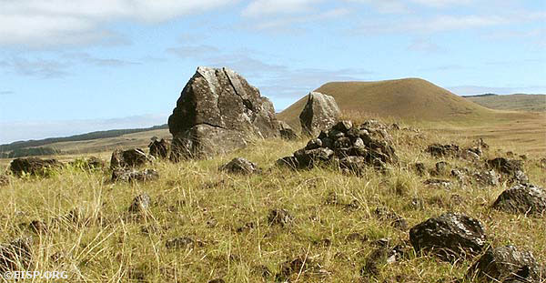
Ahu O’Pepe 20-001
Ahu O'Pepe (20-001), an inland ahu, once held seven moai and as such may be compared to Ahu Akivi (16-001).. © 2003 EISP/JVT/Photo: A. Perlin.
.©1987 EISP/JVT/Photo: D. C. Ochsner.")
Felipe Teao A. with a torso, recarved into bas-relief komari (vulva). ©1987 EISP/JVT/Photo: D. C. Ochsner.
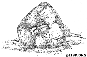
Drawing of moai Torso 20-001-006 recarved as a bas-relief komari (vulva), Ahu O'Pepe©1991 EISP/JVT/Drawing: C. Arévalo P.
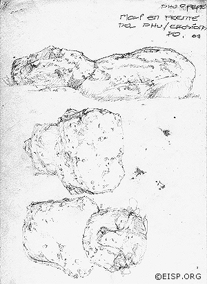
Field drawings document Moai 20-001-013 of Ahu O'Pepe. ©1991 EISP/JVT/Sketch: C. Arévalo P.
Moai 20-001-013 in situ at Ahu O'Pepe. ©1987 EISP/JVT/Photo: D. C. Ochsner.

Cristiàn Arèvalo Pakarati, with Dr. Adrienne L. Kaeppler, curator at the NMNH.
RELATED RECORD: Two moai removed from Ahu O’Pepe are currently at the National Museum of Natural History, Smithsonian Institution.
Ahu Tangi Uka
This is a small ahu located within the defined boundary of “inland” sites (more than 150 m inland). It is on private land and not accessible to the public. One large moai is present on the site. The platform itself is perfunctory, with only a single course of upright stones forming the rear wall.
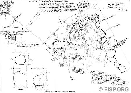
Rano Raraku Interior, Moai RR-03C-011


(Left) A composite overhead image of moai C-7 in the Rano Raraku interior quarry. Separate digital photographs were taken from a camera mounted on a hand-held boom hoisted over the moai. An attached video monitor acted as a remote viewfinder. These photos were then composited together in Photoshop to make the overhead view. The context of this moai can be seen in this map. Digital compositing by Debra Isaac.
Field Dispatches: November 2007
Dear EISP colleagues and site visitors,
Iaorana korua! Welcome to EISP’s dispatches, jottings, and journal entries, sent to you by our 2007 field team on Rapa Nui. Our records and reminders are of work done, people encountered, questions posed, and ideas explored. We are happy to share with you our adventures on Rapa Nui!
—Jo Anne Van Tilburg and the EISP 2007 Field Team
8 November 2007

We departed LAX at 1 p.m. November 2. Twenty-one plus hours and two stops later we landed on Rapa Nui under a brilliant blue colored sky sprinkled with fat puffy white clouds. The land which greeted us displayed brilliantly colored tropical plants: the familiar bougainvillea , fiery-flowered coral trees unlike the naked branches we now see at home, startling white lilies and a white-petaled daisy-like flower. Sunday we worked setting up the office at the site of the about-to-be-finished Mana Gallery which will serve as a showplace for the work of local artists. Then Alice took Jaine and me on a tour of downtown Hanga Roa, our new hometown. Monday morning we continued our walking tour as we visited the local cemetery, replete with flowers, both plastic and homegrown.
[Read More…]
Field Dispatches: July 2004

Jo Anne Van Tilburg and Matthew Bates discuss which points to take during the Rano Raraku Interior Quarry survey.
Final Mapping Season
Dear EISP colleagues and site visitors,
Iaorana korua! Welcome to EISP’s dispatches, jottings, and journal entries, sent to you by our 2004 field team on Rapa Nui. Our records and reminders are of work done, people encountered, questions posed, and ideas explored. We are happy to share with you our adventures on Rapa Nui!
—Jo Anne Van Tilburg and the EISP 2004 Field Team
12 July 2004: Preparing for Departure!
Hello! It’s the day before the big trip. I’ve been gathering up the necessary field materials and will leave the Archive at UCLA soon (I hope). We’ll be updating this page with new photos as soon as we get situated on Rapa Nui. Glad to have you along for the ride!
—Alice, Los Angeles =)
I’m happy to have all my team back on the island! It’s very exciting to think we will be able to finish the final mapping of the interior quarry. It has been very nice weather in this season (winter) and I miss Bill’s good coffee!
—Cristian, Rapa Nui
14 July 2004: Flying!

View from the flight to Rapa Nui, somewhere over the Pacific. © EISP 2004.
As we wing our way toward Rapa Nui, I am thinking of the work ahead. This is our final mapping season in Rano Raraku interior quarry!! We began our first and second field seasons with Peter Boniface of Cal Poly Pomona on our team, and on this trip one of his students, Matthew Bates, is carrying on that work, joining our team as surveyor. He will complete an important and challenging series of mapping tasks in both Sections C and D, and the statue survey points he collects will be augmented, as in past seasons, by digital and metric data.
[Read More…]
Field Dispatches 2002-2003: Three New Moai Discovered!
EISP, the Rapa Nui Community, and Island Agencies Cooperate to Preserve the Archaeological Record.
October-November 2002

Front view of red scoria moai standing in Nely Pakarati Manutomatoma’s garden. Photo by Alice Hom. © 2002 EISP.

Left view of red scoria moai standing in Nely Pakarati Manutomatoma’s garden. Photo by Alice Hom. © 2002 EISP.
Returning to Hanga Roa from fieldwork in Rano Raraku, we followed the same route every day for a month. Nearing the village, we always turned to run parallel with the airport runway. My eyes grew accustomed to the same daily blur of greenery along the opposite side of the road, and details were registered only in passing. Then one day I suddenly realized that an awkward shape standing in Nely Pakarati Manutomatoma’s neatly trimmed garden was oddly familiar. Cristián turned the truck around and we drove into her driveway where, standing propped against the house, we were stunned to recognize a large, broken, and only roughly carved red scoria moai! Nely told us that she and her family had recently found the statue, buried face up, when they had laid a foundation and concrete floor for a new terrace. She was very fond of her statue and thrilled when we carefully documented it for the EISP database. It joins the very small number of important and, in many ways, enigmatic red scoria statues we have recorded to date. [Read More…]
Field Dispatches: July 2003
")
Jo Anne Van Tilburg, Director of EISP (UCLA)
Rano Raraku Interior Mapping Project Phase Six
Dear EISP colleagues and site visitors,
Iaorana korua! Welcome to EISP’s dispatches, jottings, and journal entries, sent to you by our 2003 field team on Rapa Nui. Notes, footnotes, and field notes…our records and reminders of work done, people encountered, questions posed, and ideas explored. We are happy to share with you our adventures on Rapa Nui.
—Jo Anne Van Tilburg and the EISP 2003 Field Team
8 July 2003: Departure from LAX
Always eager to depart for Rapa Nui, I am always reluctant to leave home and family. This is, by my imprecise count, at least the twentieth journey I have made to the island since my first in 1981. Even though I’m only one of many “northern shadows flitting across a southern landscape,” I still fancy myself an explorer. I love the adventure of each new field season and its promise of discovery!
")
Susana Nahoe Arellano, Licenciada in Anthropology (Universidad de Chile)

Cristián Arévalo Pakarati, Rapa Nui Artist & EISP Co-investigator
Bill White, Alana Perlin and I are the first to depart LAX, and Peter Boniface will follow. EISP co-investigator Cristián Arévalo Pakarati will, as always, join us on our arrival on Rapa Nui. So, too, will Susana Nahoe Arellano, a new member of our team. Susana is a Licenciada in Anthropology (Universidad de Chile) with experience in Rapa Nui archaeology.
Easter Island Statue Project History: 2005-2006
GPS Mapping of Rano Raraku Quarry

EISP field crew, 2006: Henry Debey, Alice Hom, Jo Anne Van Tilburg, Cristián Arévalo Pakarati, Matthew Bates.
August 2006
Field Team
Jo Anne Van Tilburg, Ph.D. Project Director
Cristián Arévalo Pakarati, Project Co-director
Alice Hom, Database Manager
Matthew Bates, Project Surveyor
Henry Debey, Image Catalog Editor
Goals and Methods
Within Rano Raraku archaeological zone, the published maps (Cristino et al. 1981) indicate 680 localized “features” and 529 “sites.” Unlike the published survey quadrant maps, however, twenty-one types of map icons define the class of object localized. The definition and relationship of site and feature, the boundaries of a given site, and the inferred use, function, or purpose of a site or feature cluster is not clarified.

Matthew Bates sets up the base station for surveying Rano Raraku. Photo: A. Hom
Our nomenclature drops the “site” and “feature” designation and re-defines them as surveyed “objects” located and mapped on the ground and capable of being considered as either sites or features, depending upon their individual circumstances. These objects, whether singly or in clusters, have been 1 of 6 flexible interpretive use or purpose descriptions (all widely acceptable in Easter Island studies).
The EISP database has a survey identification code to denote 29 specific “object” types encountered in the field or in museum or archive collections. These object definition codes are clustered in 5 groups, with group 1 being Monumental Sculptural Objects (3-dimensional) and including moai and their frequently encountered, specific partial or complete forms.
Our field goals during this season were to complete collection of mapping points in the interior Section D; to collect mapping points on all “in transport” statues no matter where they are located, and to re-locate and document all previously mapped, non-sculptural objects in the eastern and exterior quarries.
Easter Island Statue Project History: 2004

EISP Team 2004: Matthew Bates, Debra Isaac, Cristián Arévalo Pakarati, Jo Anne Van Tilburg, Bill White, Alice Hom. ©EISP/JVT/Photo: Bill White.
GPS Mapping of Rano Raraku Interior
July-August 2004
Field Crew
Dr. Jo Anne Van Tilburg, UCLA, Project Director
Cristián Arévalo Pakarati, EISP Co-Director
Matthew Bates, Surveyor
Alice Hom, EISP Database Manager
Debra Isaac, Graphic Artist
Bill White, Photographer
Goals and Methods
Maps and images created by Chilean governmental agencies over three decades were reviewed in preparation for creating the published map of Rano Raraku in Cristino et al. Atlas Arqueólogica de Isla de Pascua, 1989. A key base document for the latter was the plan of the volcano created by Lt. D.R. Ritchie of the Mana Expedition to Easter Island, 1914. Five archaeological zones were created in Rano Raraku: interior and exterior slopes, interior and exterior quarries, and upper exterior quarries. Two quarry zones, designated C and D, in the interior, were outlined but not mapped.

Jo Anne Van Tilburg measuring height of upright moai on exterior slope of Rano Raraku. ©EISP/JVT/Photo: Alice Hom.
The goal of EISP’s seasonal mapping effort from 2002-2004 in the interior of Rano Raraku was to map all statues, outline the papa, and fully delineate the quarries in Areas C and D; to compile a contour map of the area showing the main topographical features, and to localize all previously mapped and numbered statues that are standing or fallen on the interior slopes.
An existing GPS station approximately 10 km west of Rano Raraku was established by NASA in 1998. In 2000, we placed our survey on the GPS datum WGS 84 and the UTM (Universal Transverse Mercator) projection zone 12. This is the same projection as was used for the previous survey and, therefore, provides consistent data. We established four base stations in Rano Raraku on the south side of the volcano and marked each by steel pegs placed level with the ground. These are located away from the main path and not ordinarily visible to passersby. Another three points were established in Area C and marked by wooden pegs driven in flush with the ground. These pegs were also placed away from paths so that they would remain inconspicuous and undisturbed.
[Read More…]
Easter Island Statue Project History: 2003
Rano Raraku Interior Mapping Project
 of Rano Raraku. ©2003 EISP/JVT/ Photo: A. Perlin")
Dr. Peter Boniface and Cristián Arévalo Pakarati. ©2003 EISP/JVT/ Photo: A. Perlin
Field Crew
Dr. Jo Anne Van Tilburg, UCLA, Project Director
Cristián Arévalo Pakarati, Project Co-Director
Dr. Peter Boniface, California Polytechnic University, Project Surveyor
Bill White, Photographer, Videographer
Alana Perlin, Graphic Artist, UCLA Rock Art Archive
Susana Nahoe, Project Intern
Cristián Silva, Project Intern
Goals and Methods
The specific goal of the field season was to initiate the digital and standard photographic survey of Section D; to complete the sketch map and photographic survey of Section D, and to field check the previous season’s field work in Section C. The survey was previously placed on the UTM (Universal Transverse Mercator) projection zone 12 – the same projection as was used by the previous survey (Cristino et al. 1981 Atlas Arqueólogica de Isla de Pascua). There is, however, a significant difference between the 1978 map (cited above) and our survey. Our map is based on a modern Global Positioning Survey (GPS) using the new WGS 84 figure of the earth and will include detailed measurement of all moai in Section D.
In the Field
Cristián Arévalo Pakarati constructed a hand drawn detail map of each quarry and statue located in Section D which he began last field season. This map, which compliments that accomplished in the previous season for Section C, contains on it the survey reference points. It will be used to illustrate specific archaeological and formal details of quarries and statues, and will serve as the reference guide for the computerized development via CAD of the GPS survey map described above.
Easter Island Statue Project History: October-November 2002

Cristián Arévalo Pakarati, Barry Rollett, Jo Anne Van Tilburg, and Jared Diamond at Rano Raraku. ©EISP/JVT/Photo: A. Hom.
Rano Raraku Interior Mapping Project
October-November 2002
Field Crew
Dr. Jo Anne Van Tilburg, UCLA, Project Director
Cristián Arévalo Pakarati, Project Co-Director
Gordon Hull, UCLA Rock Art Archive
Alice Hom, EISP Database Manager
Debra Isaac, Graphic Artist, UCLA Rock Art Archive
Bill White, Photographer
Goals and Methods
The specific goal of this field season was to augment previous efforts by accomplishing a digital and standard photographic survey of Section C. Further detailed measurements of all moai in Section C, as well as all of those standing outside of it on the quarry slopes, will also be accomplished. Cristián will initiate the sketch map of Section D, and Van Tilburg will field check the previous season’s field work in Section C as well as lay-out survey points for Section D. We previously used three single-frequency Ashtec GPS receivers, providing centimeter level accuracy, in our survey. It is based on an existing GPS station approximately 10 km west of the site. This station was set up by NASA in 1998 and placed our survey on the GPS datum WGS 84.
The survey was previously placed on the UTM (Universal Transverse Mercator) projection zone 12 – the same projection as was used by Cristino et al in Atlas Arqueólogica de Isla de Pascua,1981. Thus, we will provide consistent data. There is, however, a significant difference between earlier maps and our survey. Our map is based on a modern Global Positioning Survey (GPS) using the new WGS 84 figure of the earth.
Easter Island Statue Project History: July-August 2002

Peter Boniface, Project Surveyor. ©2002 EISP/JVT/ Photo: J. Van Tilburg
Rano Raraku Interior Mapping Project
July-August 2002
Field Team
Dr. Jo Anne Van Tilburg, UCLA, Project Director
Cristián Arévalo Pakarati, Project Co-Director
Dr. Peter Boniface, California Polytechnic University, Project Surveyor
Goals and Methods
The specific goal of the survey in Section C was to map every statue or possible statue and each quarry found within its boundary; to map the orientations and tilt of all prone, supine, lateral statues in relationship to Section C; to map every standing statue in the interior, and to compile a contour map of the area showing the main topographical features.
We used three single-frequency Ashtec GPS receivers, providing centimeter level accuracy. The survey is based on an existing GPS station approximately 10 km west of the site. This station was set up by NASA in 1998 and placed our survey on the GPS datum WGS 84.
Four base stations were established in Rano Raraku in relation to Section C, and were marked by steel pegs placed level with the ground. These were covered by grass and placed away from the main path so that they are not visible or dangerous to tourists or others. Another three points will be established in the working area Section D and will be marked by wooden pegs, also flush with the ground and away from the path. All pegs will be left in place; we will use them during the remaining of the survey work, and then they will be removed.
GPS Mapping of Rano Raraku Interior
Latitude 27.1247222, Longitude 109.2886111

Cristián Arévalo Pakarati and Matthew Bates survey the interior quarry slopes.
Introduction
Dynamic geographic data sets are essential to describing and interpreting the interaction of natural and human phenomena on the Rapa Nui cultural landscape. During field work conducted in Rano Raraku interior between 2005 and 2007, and in the laboratory, we examined moai presence in terms of regional territories within Rano Raraku and as a byproduct of habitual production, use, discard and reuse behaviors not directly tied to socio-political boundaries, status restrictions or resource display demands.
[Read More…]