Easter Island Statue Project History: 2003
Rano Raraku Interior Mapping Project
July-August 2003Field Crew
Dr. Jo Anne Van Tilburg, UCLA, Project Director
Cristián Arévalo Pakarati, Project Co-Director
Dr. Peter Boniface, California Polytechnic University, Project Surveyor
Bill White, Photographer, Videographer
Alana Perlin, Graphic Artist, UCLA Rock Art Archive
Susana Nahoe, Project Intern
Cristián Silva, Project Intern
Goals and Methods
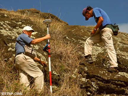
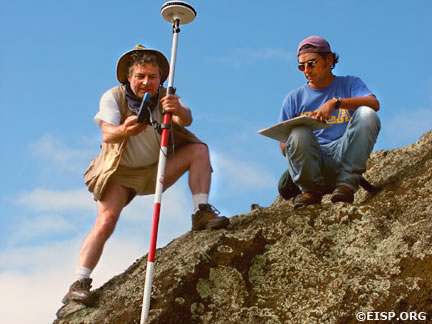
The specific goal of the field season was to initiate the digital and standard photographic survey of Section D; to complete the sketch map and photographic survey of Section D, and to field check the previous season’s field work in Section C. The survey was previously placed on the UTM (Universal Transverse Mercator) projection zone 12 – the same projection as was used by the previous survey (Cristino et al. 1981 Atlas Arqueólogica de Isla de Pascua). There is, however, a significant difference between the 1978 map (cited above) and our survey. Our map is based on a modern Global Positioning Survey (GPS) using the new WGS 84 figure of the earth and will include detailed measurement of all moai in Section D.
In the Field
Cristián Arévalo Pakarati constructed a hand drawn detail map of each quarry and statue located in Section D which he began last field season. This map, which compliments that accomplished in the previous season for Section C, contains on it the survey reference points. It will be used to illustrate specific archaeological and formal details of quarries and statues, and will serve as the reference guide for the computerized development via CAD of the GPS survey map described above.
We accomplished further standard, black and white photography and digital photography, and added videography. Photographs and negatives are contained in scanned computer files, along with historical photographs, excavation records, measurements, digital photographic records, and photogrammetric documentations. We also recorded details of rock art superimposed on statues and quarries. Finally, we traced the statue transport roads and further documented selected statues on them (previously recorded during our 1983-1984 field seasons).
Findings
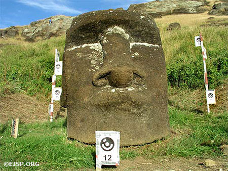
The number of statues in Section D was estimated to be about 60, but the total number of features was not known. A fire had occurred in the quarry prior to our October arrival, and it revealed a series of features we designated AF I-AF IX. Three new heads, 1 shaped block (a possible torso), 2 fragments of statues and 3 new portions of papa were exposed. In Section D, we documented 44 moai, 17 heads/faces, and 9 blocks being shaped to form statues.
EISP will continue to document and describe, using the aforementioned digital mapping and photographic techniques, the remaining statues in Section D during the next field season. Finally, we will correlate and file all findings in both Sections C and D in computer-based files, which will then be keyed to the digital field map produced in CAD.
Conservation and Public Outreach
EISP is the world’s largest and most fully detailed archive of moai descriptive data. It spans a time frame of 20 years and includes over 10,000 visual images; 4,000 graphic images; 46,000 metrics and hundreds of pages of fieldnotes, drawings and maps. All data are filed on CD-ROM and stored in archival conditions. Comparative analyses illustrate that all moai have been subjected to environmental damage. Every effort to restore, conserve or reconstruct moai, in or out of Rano Raraku, requires or depends upon these data. We have made detailed records, both visual and narrative, of the stone condition in the interior. It is noteworthy that grass and other vegetation provide a significant hazard to moai integrity.
As suggested by CONAF, EISP provides signs stating the nature of the project for the edification of tourists who passed by during our fieldwork. This was very successful, and encouraged tourists and guides to inquire about the project and discuss conservation of the statues relative to foot traffic patterns within the quarry. The addition of Rapanui interns to our project was a huge success on both sides.

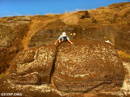
Jo Anne Van Tilburg taking measurements of a moai in Rano Raraku Interior Quarry. ©2003 EISP/JVT/ Photo: A. Perlin.
Want to Know More?
Read the Dispatches from the 2003 Field Crew.
 English
  Español

